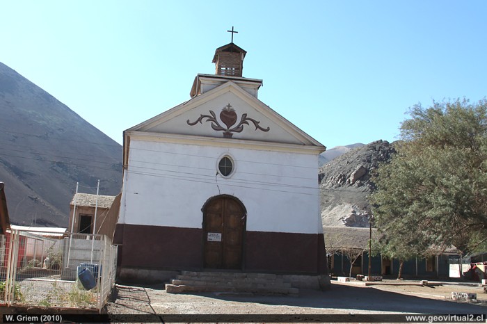
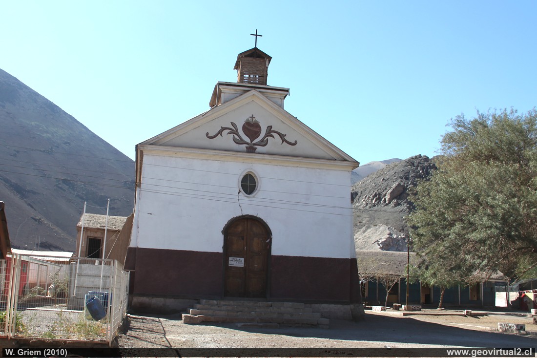
Photo: The front of the chapel of San Antonio, Atacama Region. (Ca50D 765; W.Griem 2010) - en grande
Photo Information:
Camera Canon 50D
Lens: 18mm-200mm | Focal length: 18mm
(29/35mm)
| Time: 1:125 | ISO100
F: f/10 | Original size: 4752 x 3168 | Date: 2010/07/21/12:54 hrs.
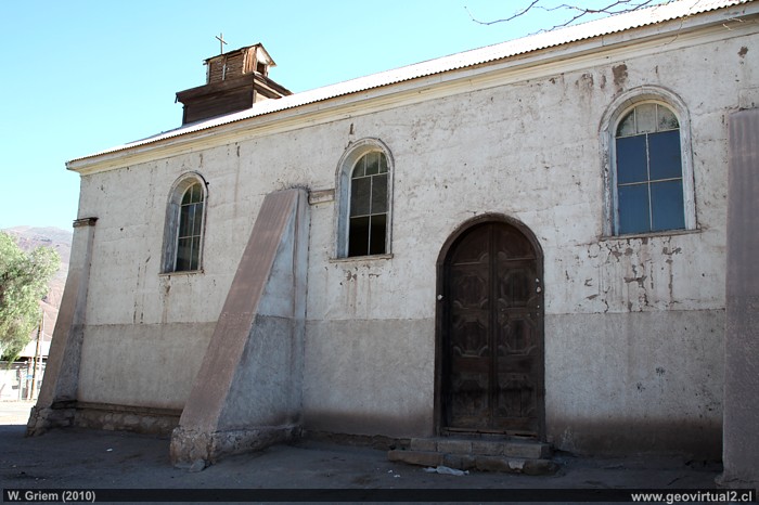
Photo: San Antonio Chapel; Atacama Region - Chile (Ca50D 780; W.Griem 2010) - en grande
Photo Information:
Camera Canon 50D
Lens: 20mm | Focal length: 20mm (32,2/35mm)
| Time: 1:200 | ISO100
F: f/5 | Original size: 4752 x 3168 | Date: 2010/07/21/12:56 hrs.
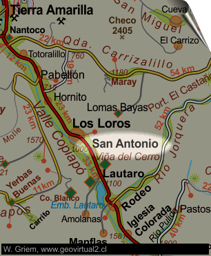
Atacama: San Antonio
The village of San Antonio is located between Los Loros
and Lautaro. From Los Loros it is 9 kilometers passing several fruit
companies. The village is notable for its chapel of a very particular
style dating from 1896.
The village height is 978 m. above sea level.
In the past, San Antonio was a very important town. Demographic
statistics for the years 1875 and 1895 show a population of over 600
people. In comparison, Los Loros had fewer than 550 inhabitants at the
same time.
"In the beginning San Antonio was immediately named for his rich
silver mines" (Domeyko, 1904).
For a short time the railway line from
Copiapó reached San Antonio. A line extension to Argentina was even
planned for this place (see
here more). The inauguration of the line dates back to February
1867, but in 1882 it was reported that the line was abandoned and
destroyed in parts. After the construction of the railway line, a
telegraph line was opened to San Antonio (1881). Pérez-Rosales (1859)
reported that the extension of the railway line to San Antonio provoked
a strong economic development of the sector. KUNZ (1890) mentions
successful watermelon plantations in San Antonio that are exported
north.
During the earthquake of 26 May 1851, San Antonio was completely
destroyed.
From San Antonio, 4 kilometers to reach the Inca smelter "Viña del
Cerro".
See Atacama Books Collection
Informative Chart:
Location Information:
UTM: E396.389 / N69.16.170
Altitude: 978m - 1006m
Distance to Copiapó: 70,1 km
Places of interest
Information about Atacama

Intro valle Río Copiapó
Copiapó (Km 0,0)
Tierra Amarilla (km 15,7)
Nantoco (Km 22,2)
Sector Nantoco
The Copiapó river
-
a Cerro Blanco
Punta Brava (Km 53,7)
Los Loros (Km 62,3)
►
San Antonio
(Km 70,1)
Smelter Inka (Km 74,0)
Aqueduct
Amolanas (Km 82,2)
Reservoir Lautaro (Km 84,2)
Iglesia Colorada (Km 110,1)
Río Montosa (Km 115,4)
Junta de Potros (Km 118,9)
La Semilla
Pastos Grandes (Km 137,1)
Qda. Pircas Coloradas (146,1)
Port. Cachitos (Km 167,1)
Río Turbio (Km 194,5)
Domeyko: Excursión al valle del río Copiapó 1843
Del sector
FFCC Copiapó - San Antonio
Mapa del sector
Sector en 3D
Qda. Carrizalillo
Valle Copiapó abajo
Related pages
GILLISS excursion Come Caballo
The Andes mountains
Atacama desert
History
of Atacama
Mining history of Atacama
Pages of interest
The railroad history of Atacama
Mining history of Atacama
History
of Atacama
Virtual vantage point to the Desert
Vida Atacama en b/n

