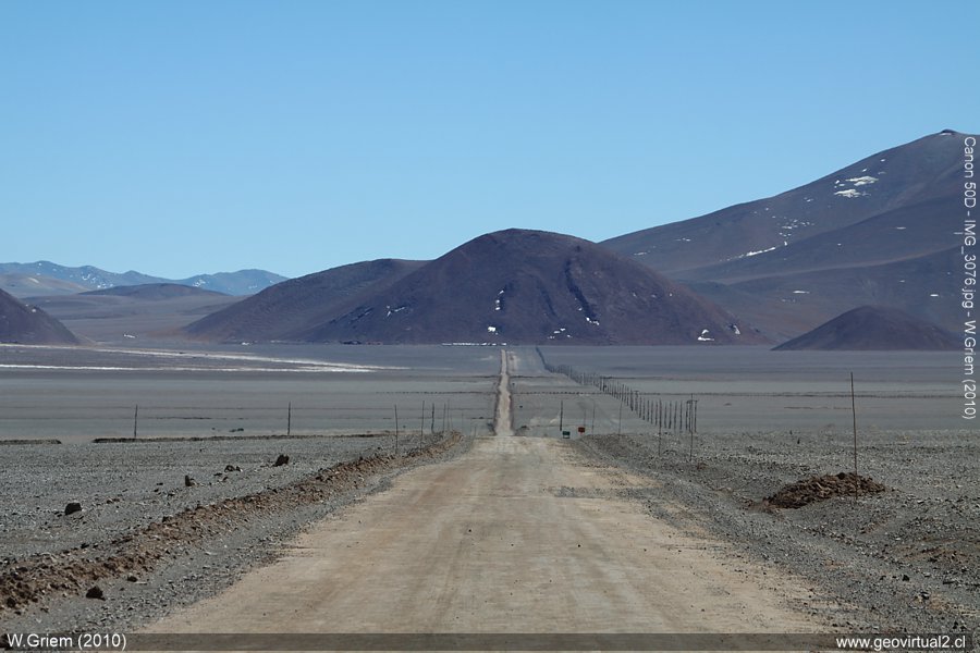
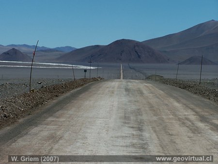
Photo: Salar de Maricunga, road from the border complex to Portezuelo Lama; Atacama Region - Chile. Photo W. Griem (2010) Ca50D3076 - Large Photo
Photo Information:
Camera Canon 50D [IMG_3076.jpg]
Lens: 55-250mm | Focal length:
123mm (196/35mm) | Time: 1:400 | ISO100
F: f/10 | Original size: 4752 x 3168 | Date: 2010/09/16/11:35 hrs.
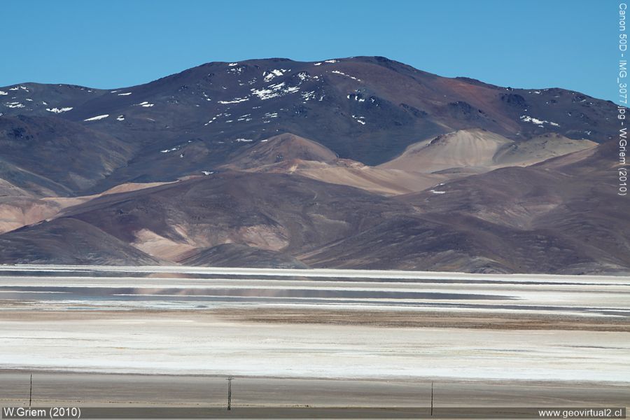
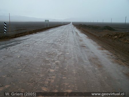
Photo:
Salar de Maricunga from the road to Paso San Francisco; Atacama Region -
Chile. (W. Griem, 2010;
Ca50D3077)
Large Photo
Photo Information:
Camera Canon 50D [IMG_3076.jpg]
Lens: 55-250mm | Focal length:
146mm (232mm/35mm) | Time: 1:320 | ISO100
F: f/10 | Original size: 4752 x 3168 | Date: 2010/09/16/11:35 hrs.
Salar de Maricunga: p. 1 | p. 2
The Maricunga Salt Flat landscape satisfies all those who like to have clean straight lines in the landscape. The dimensions of the mountains and hills blur in the vastness of the landscape. Due to the clear, thin air, you can easily consider 20 and more kilometers to be quite close.
In this area, heavy rainfall can also occur in the summer (January,
February) due to the "Invierno altiplanico".
The main route
continues via the Lama Pass to Laguna Verde and finally to the San
Francisco Pass.
You can also take the path towards Santa Rosa and
continue to the Negro Francisco lagoon (or back to Copiapó)
The Salar
de Maricunga is the salt flats located further south from all the salt
flats of the Andes of Chile. The salt flat is connected to Laguna Santa
Rosa. As the amount of precipitation reaches high values in these
latitudes and the evaporation of water by the sun is not so strong, the
formation of salt flats in these latitudes is very restricted.
The
main roads near the salt flats are in good condition; be careful to
approach with the vehicle to the salt flats. There are pits of "chusca"
(fine dust), and some sectors show soft soils.
Information:
Data: Customs station, Salar de Maricunga
Provincia Copiapó
Comuna Copiapó
UTM: E495.690 / N70.31.595
Height: 3785 m
Distance to Copiapó via La Coipa: 170 km
Distance to Copiapó via Pedernales: 346 km
Distance to Diego de Almagro: 179 km
Places of interest
Information about Atacama
Intro Camino
Internacional
Chulo (km 24,3)
Puquios(km 57,5)
Empalme La Puerta (km 75,0)
El Salto
(km 80,4)
San Andrés (km
90)
Majada Andrés (km 96,6)
Azufrera (km 141,9)
Port. Codocedo (km 150,1)
► Salar
Maricunga (km 167,5)
Qda. Ciénaga Redondo
Pantanillo
Laguna N. Francisco
Río Lama (km 198,5)
Cascada Río Lama (km 199,5)
Llano Piedra Pómez
Barrancas Blancas (km 240,0)
Ex. Hostal Muray
Ojos del Salado (km 244,2)
Laguna Verde
(engl.) (km 256,6)
Incahuasi
Paso San Francisco (km 276,9
Nearby and more
Santa Rosa lake
Río Lama
The Andes mountains
Atacama desert
Related pages
Roads of Atacama
Distances between ....
Road
maps
Mining history of Atacama
Mapa histórica del sector (Bertrand, 1885)
Mapas
Tourist
information
Atacama
Travel instructions
Behavior in the desert
Specific terms
The Andes mountains
Atacama desert
Other units
Atacama black and white
Virtual viewpoint Atacama
Collection of Books

