
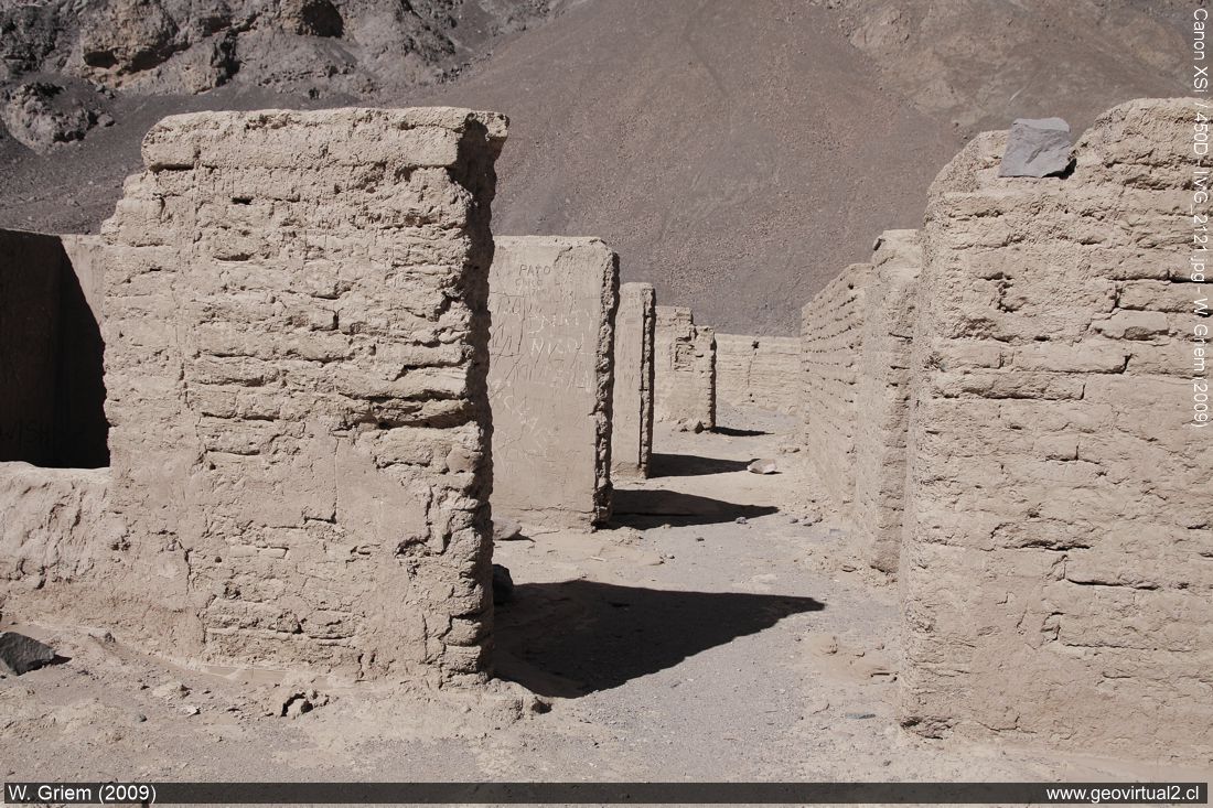
Photo: Ruins of Puquios in the Paipote Quebrada (W. Griem, 2009; CaXSi2121) - Large Photo

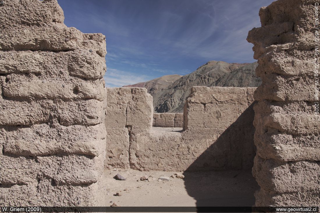
Photo: Ruins of Puquios in the Paipote Quebrada. (W. Griem 2009; CaXSi-2122) Large Photo
Photo Information:
Camera Canon XSi | Lens: 17-70mm(pol) | Focal Length: 17mm | Time: 1:80
| ISO100
F: f/7.1 | Original size: 4272 x 2848 | Date:
2009/07/09/12:54hrs.
Puquios: p. 1 - p. 2 - p. 3 - p. 4 - Railroad - Sofía Mine
Currently, the international road [camino internacional]
is in good condition (paved with salt) and joins
Copiapó
with the
Salar
de Maricunga and Argentina.
Also, there is an exciting road
from Puquios to
Carrera
Pinto -
Inca de Oro
[here] (in 2010 passable)
that represents the old main road to
Inca de Oro
(Cuba). [this road]
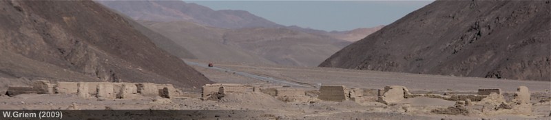
The dynamics of the mud streams during heavy rainfalls, unfortunately,
destroyed much of the abandoned town. The sporadic torrential rains of
the last decades eroded a large part of the town.
| from Puquios to . . . | km |
| Copiapó | 57,5 |
| Salar de Maricunga | 110,0 |
| Laguna Santa Rosa | 89,5 |
| Bencina (Paipote) | 49,8 |
| La Baritina | 10,2 |
| Empalme La Puerta | 17,5 |
Description of the station of Puquios by
Santiago Muñoz (1894) - The observations refer to the year 1883:
The station of Puquios is the end of the Copiapo railway that advances
to the east: it is comfortable and spacious, and contains good
warehouses and corrals for merchandise, carts and animals.
To one of the sides of the station, to the north, and forming a street
with it is the Puquios village, four blocks long and with small and
insignificant buildings.
But still, even though everything is quite limited here, there is a
restaurant, a hotel and a company with carriages, which goes to Tres
Puntas every Monday and Friday when the trains arrive from Copiapó.
The mineral processing of Puquios is the best in the region, at present
(1883) minerals from the Buena Esperanza Mine of Chimberro and Tres
Puntas are processed here.
Places of interest
Information about Atacama

Intro Camino
Internacional
Chulo (km 24,3)
► Puquios (km 57,5)
Empalme La Puerta (km 75,0)
El Salto
(km 80,4)
San Andrés (km
90)
Majada Andrés (km 96,6)
Azufrera (km 141,9)
Port. Codocedo (km 150,1)
Salar
Maricunga (km 167,5)
Qda. Ciénaga Redondo
Pantanillo
Laguna N. Francisco
Río Lama (km 198,5)
Cascada Río Lama (km 199,5)
Llano Piedra Pómez
Barrancas Blancas (km 240,0)
Ex. Hostal Muray
Ojos del Salado
(engl.) (km 244,2)
Laguna Verde
(engl.) (km 256,6)
Incahuasi
Paso San Francisco (km 276,9
Related pages
Roads of Atacama
Distances between ....
Road
maps
Mining history of Atacama
Tourist
information
Atacama
Travel instructions
Behavior in the desert
Specific terms
The Andes mountains
Atacama desert
Other units
Atacama black and white
Virtual viewpoint Atacama
Collection of Books
Atacama black and white
Puquios

