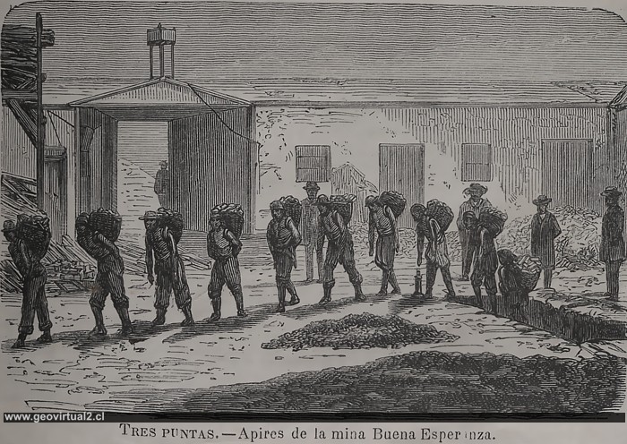
Tornero (1872):Mina Buena Esperanza, en la Región de Atacama, distrito Tres
Puntas (Chile).
Figura en grande
véase también cancha de minerales de Buena Esperanza
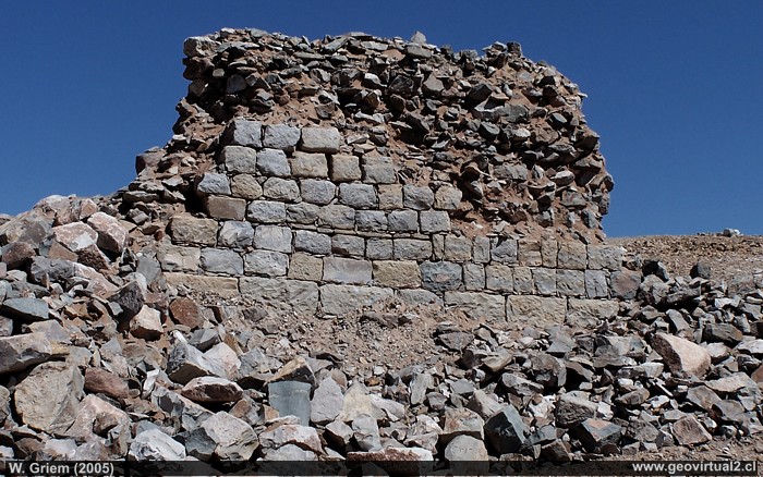
Photo: Mina Buena Esperanza in the Chimbero - Tres Puntas sector (Atacama Region / Chile). Foto: W. Griem (2005); Kodak7322 - Large Photo
Información Foto: Cámara Kodak DX6490 (100_7322.jpg)
Longitud focal: 12,4,9mm (=75/35mm)
| Tiempo: 1:350
F: f/7.1 | Tamaño original: 2304 x 1728 | Fecha:
2005/09/25/14:28 hrs.
B. Esperanza: p.1 | p.2 | p.3 | Hist | Data
The drawing by
Recaredo Tornero (1872) is an excellent example of the Tres
Puntas/Chimbero representation in literature at this time. The miners'
faces are all covered by a black shadow, a considerable load presses on
their backs - you can see the people's exhaustion. You can see a group
of four or five people receiving the ore cargo behind the miners. The
posture and clothing of this group suggest a slightly elevated position
in the mine. The building's appearance - the walls in weak, soft tones -
in a very similar form is depicted here the desert, which the open gate
can recognize. Even in the remains and ruins that visitors can still see
today, it is easy to realize that the mining industry had a relatively
high technical standard in the Buena Esperanza mine. In addition to many
solid buildings, the remains of a lime furnace can also be detected.
Unfortunately, open-pit mining has been carried out in the last years of
operation, and some building complexes are lost forever.
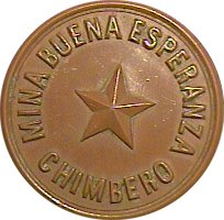
20 cent chip from the Buena Esperanza mine
(Collection Miguel Díaz)
Mining Atacama
History of Atacama
Mining and Mines
List
of mine districts
Mining
between 1830-1920
Chañarcillo
Tres Puntas
Village of Tres Puntas
Cemetery of Tres Puntas
►
Mine of Buena Esperanza
Mina Cobriza
Cronología de Tres Puntas
Historical records
Treutler, living in Tres Puntas
Treutler:
Salvadora mine
Philippi en Tres Puntas
más Tres Puntas
Cerro Blanco
district
Lomas Bayas
Agua Amarga
Distrito Inca de Oro
Puquios - Carrera Pinto
Carrizal Alto
Checo de Cobre
More mining districts ...
Area Tres
Puntas
Estación FFCC Chimbero
Inca de Oro
village
Carrera Pinto
(ruins)
Distrito Inca de Oro
Ruta Copiapó - Diego de Almagro
Additional information
Timeline Atacama
Railroad history of Atacama
History of Atacama
Mining history of Atacama
Atacama black and white
Road maps of Atacama
Historical maps of Atacama
Persons of Atacama

