
Photo: Cemetery of Tres Puntas (W.Griem, 2011;
Ca50D10333)
Large Photo
Información Foto: Cámara Canon 50D: [IMG_0333.jpg]
Lente: 55-250mm | Longitud focal: 96mm (153/35mm) | Tiempo: 1:400 | ISO100
F: f/11 | Tamaño original: 4752 x 3168 | Fecha: 2011/10/31/15:23 hrs.

Photo: Tres Puntas Cemetery in the middle of the Atacama Desert. W. Griem,
2002 (CaA100-293
)
Foto en grande
Información Foto:
Cámara Canon Powershot-A100 [102-0293_IMG.jpg]
Longitud focal: 5,41mm (=44mm/35mm) | Tiempo: 1:1000
F: f/5.6 | Tamaño original: 1027 x 768 | Fecha: 2002/11/01/14:11 hrs.
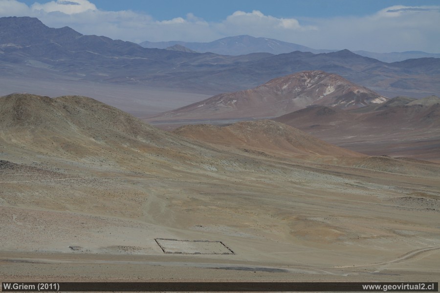
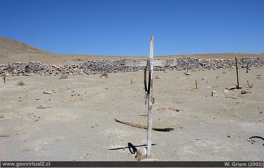
Cemetery of Tres Puntas
The cemetery of Tres Puntas is located in the middle of
the desert. Only a wall of considerable dimensions marks the boundaries.
The cemetery of Tres Puntas is in a state of disappearance. Some crosses
are still visible, but no name has been preserved.
Cemeteries in general are the most impressive vestige of the abandoned
mining sectors. In Tres Puntas, up to 4000 people lived in the middle of
the desert, without water, without the possibility of growing fruits and
vegetables.
In the late 1890s the silver bonanza ended and the mines closed, people
left the town, the cemetery was left alone.
The cemetery dimensions are 60 m by 80 m, but the area does not form a
perfect rectangle, you notice an error of some 5 meters.
The enclosure is surrounded by a wall of loose rocks from the sector,
about 1.50 m high. The direction (axis) of the cemetery is 295° or N65W.
Mining Atacama
History of Atacama

Mining and Mines
List
of mine districts
Mining
between 1830-1920
Chañarcillo
Tres Puntas
Village of Tres Puntas
►
Cemetery Tres Puntas
Buena Esperanza mine
Mina Cobriza
Cronología de Tres Puntas
Historical records
Treutler, living in Tres Puntas
Treutler:
Salvadora mine
Philippi en Tres Puntas
más Tres Puntas
Cerro Blanco
district
Lomas Bayas
Agua Amarga
Distrito Inca de Oro
Puquios - Carrera Pinto
Carrizal Alto
Checo de Cobre
More mining districts ...
Area Tres
Puntas
Estación FFCC Chimbero
Inca de Oro
village
Carrera Pinto
(ruins)
Distrito Inca de Oro
Ruta Copiapó - Diego de Almagro
Information
Atacama
History
of Atacama
Cronología de la Región
Mining history of Atacama
Railroad history of Atacama
Cartas y Mapas de Atacama
Cartas históricas de Atacama
Listado personajes de Atacama

