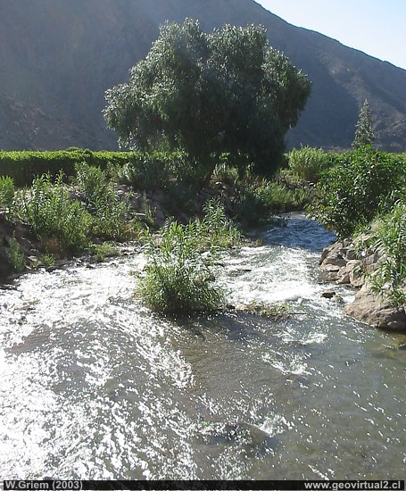
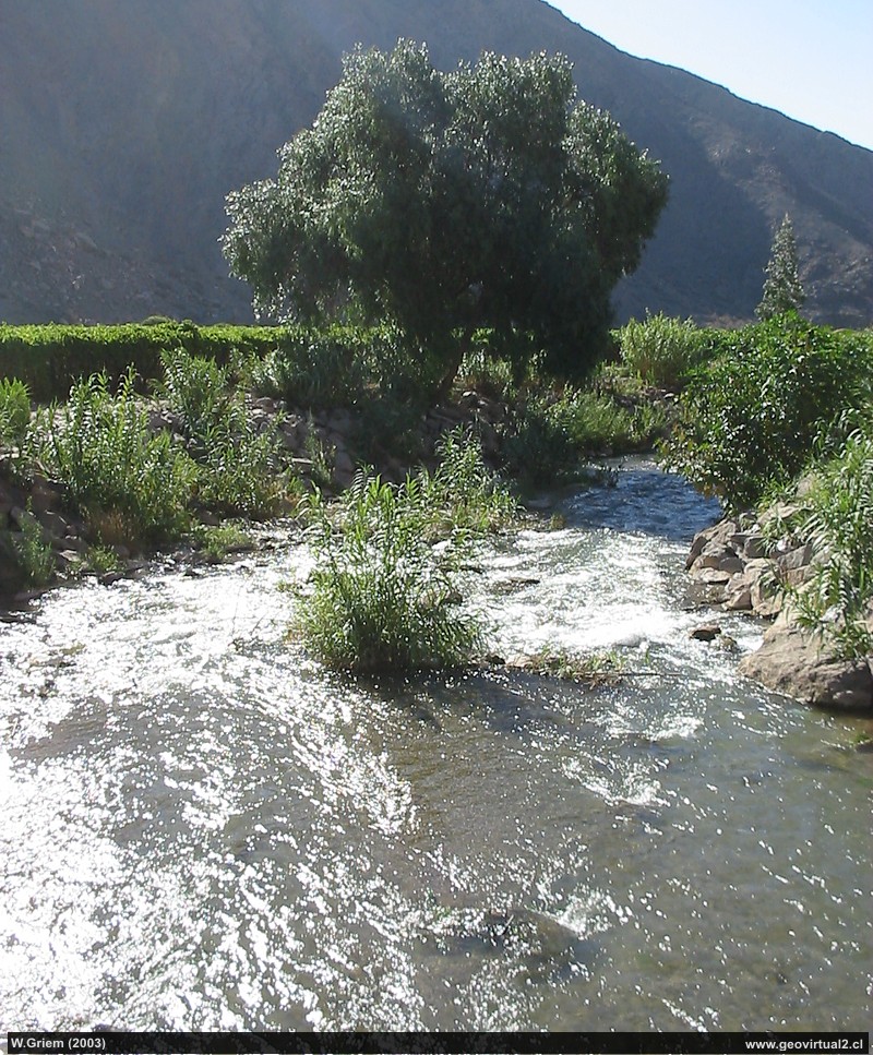
Photo: Copiapó river near El Yeso; Atacama Region: Here at this altitude, near Nantoco still has water.. W. Griem (Canon Powershot - 2003) - Foto grande
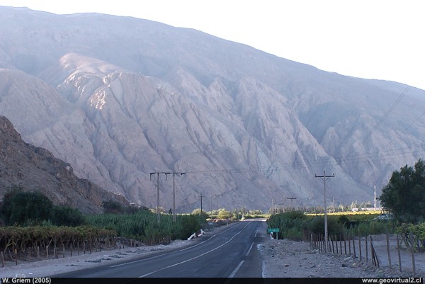
Photo: Yeso Sector - Potrero Seco; Atacama Region - Chile: The mountain range of strata, almost vertical, marks the sector.. W. Griem (2005; Kodak4279) - Foto en grande
Atacama: Copiapo river
The Copiapó River:
In the Nantoco - El Yeso - Pabellón sector, the Copiapó river generally
contains a considerable flow. On the other hand, further down, between
Tierra Amarilla and San Pedro there is a decrease in the riverbed or
simply the river becomes dry.
On average it has a flow rate of 1.9 m3 / second, but after rainy years
this figure increases. It is worth mentioning that it is very difficult
or simply not very useful to characterize the Copiapó River with general
statistical methods. Especially the high variations per year, decade or
century do not allow the elaboration of a general guideline. Just one
event - a rainy year - can change the figures for decades.
The Copiapó river basin covers an area of about 18,400 km2. But a large
amount of tributaries do not have a permanent flow - it is only
activated after heavy rains. The precipitation rate generally increases
considerably towards the mountain range. This is why rivers such as
Pulido, Cachito and Montosa show a good flow throughout the year. On its
way down the Copiapó River, the river loses its flow for several
reasons: natural reasons such as evaporation and downward filtration, in
addition to anthropogenic reasons: agronomy, mining and the pumping of
drinking water consume a great deal of water resources.
In "Potrero Seco" cretaceous rocks, strongly sloping intercept the
valley.
Formerly in this place the railroad to Chañarcillo (see
here) turned west to climb up to Molle.
In Potrero seco there is also the junction of the road that leads to
Cerro Blanco - Yerbas Buenas. (see
here)
Cuadro Informativo:
Gilliss (1855):
"Within twelve miles of the city the road at last approaches the river;
but what sort of stream does the reader picture to himself? one like the
Delaware, or Thames, or Seine ? The geographical student would be warranted
in such belief on inspection of the old maps ; and such a stream as either
would be a source of wealth more valuable than all the riches of Tres Puntas.
No, no; the river Copiapó is but a trench half filled with water, not a
foot deep, and across which you may easily stride."
Charles Darwin
(1835, 11. June):
The valley of Copiapo, forming a mere ribbon of green in a desert, runs
in a very southerly direction; so that it is of considerable length to
its source in the Cordillera. The valleys of Guasco and Copiapo may both
be considered as long narrow islands, separated from the rest of Chile
by deserts of rock instead of by salt water. Northward of these, there
is one other very miserable valley, called Paposo, which contains about
two hundred souls; and then there extends the real desert of Atacama --
a barrier far worse than the most turbulent ocean. After staying a few
days at Potrero Seco, I proceeded up the valley to the house of Don
Benito Cruz, to whom I had a letter of introduction. I found him most
hospitable; indeed it is impossible to bear too strong testimony to the
kindness with which travellers are received in almost every part of
South America. The next day I hired some mules to take me by the ravine
of Jolquera into the central Cordillera. On the second night the weather
seemed to foretell a storm of snow or rain, and whilst lying in our beds
we felt a trifling shock of an earthquake.
see Charles Darwin
Places of interest
Information about Atacama
Intro valle Río Copiapó
Copiapó (Km 0,0)
Tierra Amarilla (km 15,7)
Nantoco (Km 22,2)
Sector Nantoco
►
The Copiapo river
FFCC Chañarcillo
Portezuelo Dadín
Cerro Blanco
Yerbas Buenas
Punta Brava (Km 53,7)
Los Loros (Km 62,3)
San Antonio (Km 70,1)
Smelter Inka (Km 74,0)
Aqueduct
Amolanas (Km 82,2)
Reservoir Lautaro (Km 84,2)
Iglesia Colorada (Km 110,1)
Río Montosa (Km 115,4)
Junta de Potros (Km 118,9)
La Semilla
Pastos Grandes (Km 137,1)
Qda. Pircas Coloradas (146,1)
Port. Cachitos (Km 167,1)
Río Turbio (Km 194,5)
Del sector
FFCC Copiapó - San Antonio
Qda. Carrizalillo
GILLISS excursion Come Caballo
Related pages
The Andes mountains
Atacama desert
History
of Atacama
Mining history of Atacama
Páginas of interes
The railroad history of Atacama
Mining history of Atacama
History
of Atacama
Virtual vantage point to the Desert
Vida Atacama en b/n

