
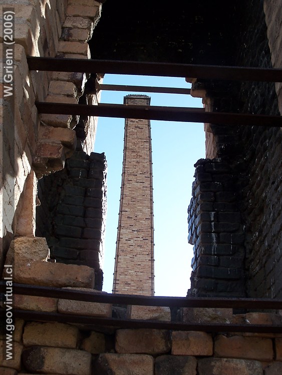
Photo: Chimneys of Labrar. (Photo W. Griem; 2006;
Kodak-10575)
Large photo
Photo Information: Kodak DX6490
Camera (100_0575)
Focal length: 8.5mm (=71/35mm) | Time: 1:180
F: f/4.5 | Original size: 2304 x 1728 | Date: 2006/10/07/17:45 hrs.

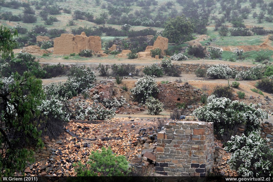
Photo: Landscape of the Labrar sector (Atacama
Region; Chile) with the former foundry after a heavy rainfall. (Photo W.
Griem; 2011; Ca50D-9183)
Large Photo
Información Foto: Cámara Canon 50D: [IMG_9183.jpg]
Lente: 17-70mm | Longitud focal: 57mm (90,9/35mm) | Tiempo: 1:100 | ISO100
F: f/5.6 | Tamaño original: 4752 x 3168 | Fecha: 2011/08/14/13:14 hrs.
Chimneys from Labrar: p.1 | p.2
The geographical location of the historic copper
smelting works is quite astonishing: not directly on the coast, but also
not in the immediate vicinity of the mines. It should be remembered that
in 1830 the ship was the only means of transport that could transport
large quantities. The transport route overland was arduous, expensive
and unsafe, and the more powerful railway did not arrive at Atacama
until 1851. Important in this period was the short distance between the
mine and the melt, because more than 80% of the exploited material was
useless.
But the transport of imported fuel, in this case coal, was also very
expensive, and so the location between the mine and the port was
probably the most favourable.
Information:
Location: Labrar, Atacama region
Comuna Freirina, Provincia Huasco
Height 635m
Location (UTM): E281.000 / N68.20.163
beeline to Freirina: 29,5 km
Street-kilometre to Freirina: 45,6 km
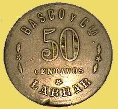
50 cent chip Labrar
(Colección Miguel Díaz)
The "chimneys de Labrar" complex is a national monument. The extraction and alteration of any species in the sector is not allowed!
Atacama virtual
Mining Atacama
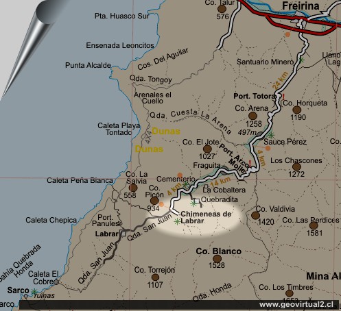
Introduction to Labrar
Observation platform (km 6,6)
Totora Pass
(km 16,9)
Sauce
Perez (km 22,8)
Loma Suelta
(km 24,0)
Arco Molle Pass
(km 32,5)
Fraguita
(km 35,1)
Kobaltminen
(km 39,3)
Friedhof (km 41,4)
Quebradita (km 44,2)
●
Labrar smelter
(km 45,6)
Other
smelters
Dulcinea
Canto del Agua
Labrar
Higirio
Agua Amarga
Viña del Cerro
Tourist
information
Atacama
Travel instructions
Behavior in the desert
Specific terms
The Andes mountains
Atacama desert
Related pages
Roads of Atacama
Distances between ....
Road
maps
Mining history of Atacama
Atacama landscape
The Atacama desert
Flowering
Atacama desert
Beaches of Atacama
Las Dunas
de Atacama
Others
Railroad history of Atacama
History
of Atacama
Mining history of Atacama
Flora Atacama
Fauna Atacama
Geología Atacama
Climate of the Atacama Region
Atacama desert
Beaches of Atacama
The Andes mountains
Rutas de Atacama
Carretera Panamericana
Aeródromos en Atacama
