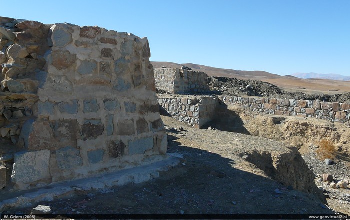
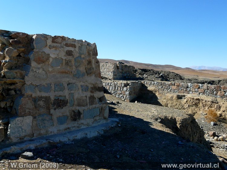
Photo: Ruins of the Tres Puntas in the Atacama Region (Chile). (Foto Wolfgang Griem 2008 ;P4580) - Foto en grande
Información Foto:
Cámara Panasonic DMC-FZ18 [P1040850.jpg]
Longitud focal: 6mm (37/35mm) | Tiempo: 1:160 |
ISO100
F: f/8 | Tamaño original (px): 3264 x 2448 | Fecha: 2008/07/15/16:02hrs.
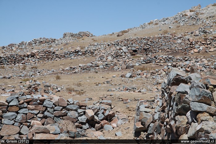
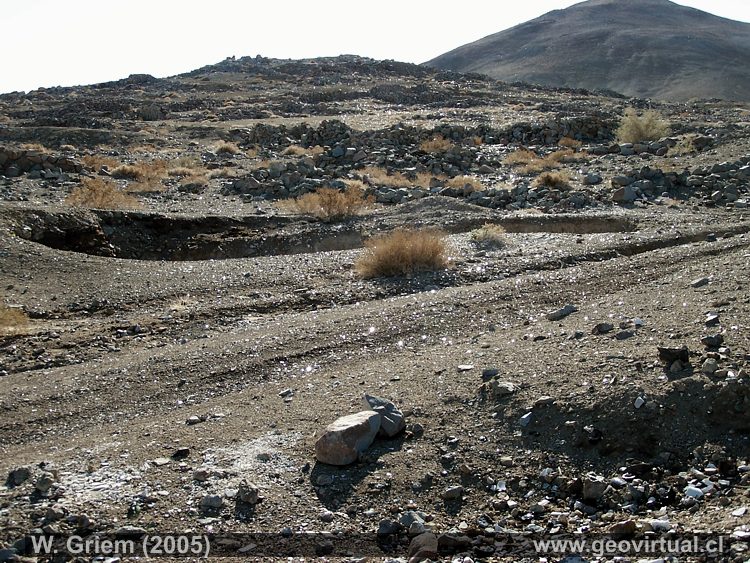
Photo: Ruins of the Tres Puntas, Atacama Region; Chile. (Foto Wolfgang Griem, 2012; Ca50D6594) Large Photo
Información Foto: Cámara Canon 50D: [IMG_6549.jpg]
Lente: 18-135mm | Longitud focal: 87mm (138/35mm) | Tiempo: 1:200 | ISO100
F: f/14 | Tamaño original: 4752 x 3168 | Fecha: 2012/11/02/11:33 hrs.
Tres Puntas: p.1 │ p.2 │ p.3 │ p.4
There is generally little scientific information,
especially geological information on the sector. The literature and
historical descriptions of Tres Puntas have an approach to human life -
everyday life in this sector. This also extends to the images of the
period between 1850 and 1880. In
Treutler,
Philippi and Tornero's publications, mainly the miner is in the
forefront - technology hardly appears.
Geology of the sector:
These are high grade vetiform (here)
mineralizations in Ag. The deposits usually do not enter at the diorite.
High-grade sectors are located near the surface. Downward the grade is
lowered. There is probably a relationship to the surrounding limestones.
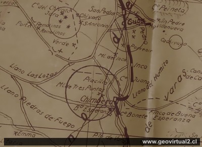
Map of Harding (1919/1936)
Mining Atacama
Journey to Atacama
Mining and Mines
List
of mine districts
Mining
between 1830-1920
Chañarcillo
Tres Puntas mining district
►
Pueblo de Tres Puntas
Cemetery of Tres Puntas
Buena Esperanza
mine
Mina Cobriza
Cronología de Tres Puntas
Historical records
Treutler, living in Tres Puntas
Treutler:
Salvadora mine
Philippi en Tres Puntas
más Tres Puntas
Cerro Blanco
district
Lomas Bayas
Agua Amarga
Distrito Inca de Oro
Puquios - Carrera Pinto
Carrizal Alto
Checo de Cobre
More mining districts ...
Area Tres
Puntas
Estación FFCC Chimbero
Inca de Oro
village
Carrera Pinto
(ruins)
Distrito Inca de Oro
Ruta Copiapó - Diego de Almagro
Additional information
Historia de la Región Atacama
Cronología de la Región
Mining history of Atacama
Railroad history of Atacama
Cartas y Mapas de Atacama
Cartas históricas de Atacama
Listado personajes de Atacama
