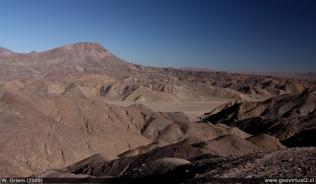
Photo: View of the viewpoint near the road that joins Copiapó with Inca
de Oro. Below it is the Paipote Creek, near the junction towards Qda.
San Miguel. In the background you can see Cerro Cinchado. See the sector
in the tourist route
here
(CaXSi3287;
W.Griem 2009)
Description:
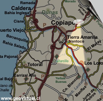
Location: Viewpoint at Llampos.
Nearest town: Paipote (24 km), Copiapó (34 km)
Petrol: Paipote (24 km)
Road condition: Asphalted, only the last 500 meters in the terrain -
SUV, 4X4, jeep, pickup, otherwise 200 meters on foot.
Worth seeing: viewpoint, landscape.
UTM: E392.138 / N69.81.915 - Height: 990 m.
Information Photo:
Canon Camera XSi
Lens: 17-70mm + pol. | Focal length: 23mm (37,6/35mm)
| Time: 1:125 | ISO100
F: f/8 | Original size: 4272 x 2848 | Date: 2009/07/22/15:29hrs.
Viewpoint Atacama
Places of interest

Content Viewpoint Atacama
Landscapes of Atacama desert:
Paipote ravine from Llampos
Desde la mina Aguilar
Tiro Plain
Lomas Bayas hacia Port. Dadin
Cementerio de Lomas Bayas
Pre-cordillera con nieve
La Sierra Peineta
El Salado
Qda. Paredones
Cerros de Merceditas
Leoncito - El Patón
Portezuelo Chinches - Tambaría
Cerro Cadillal o Anselmo
The sector
more information of the Ojos site