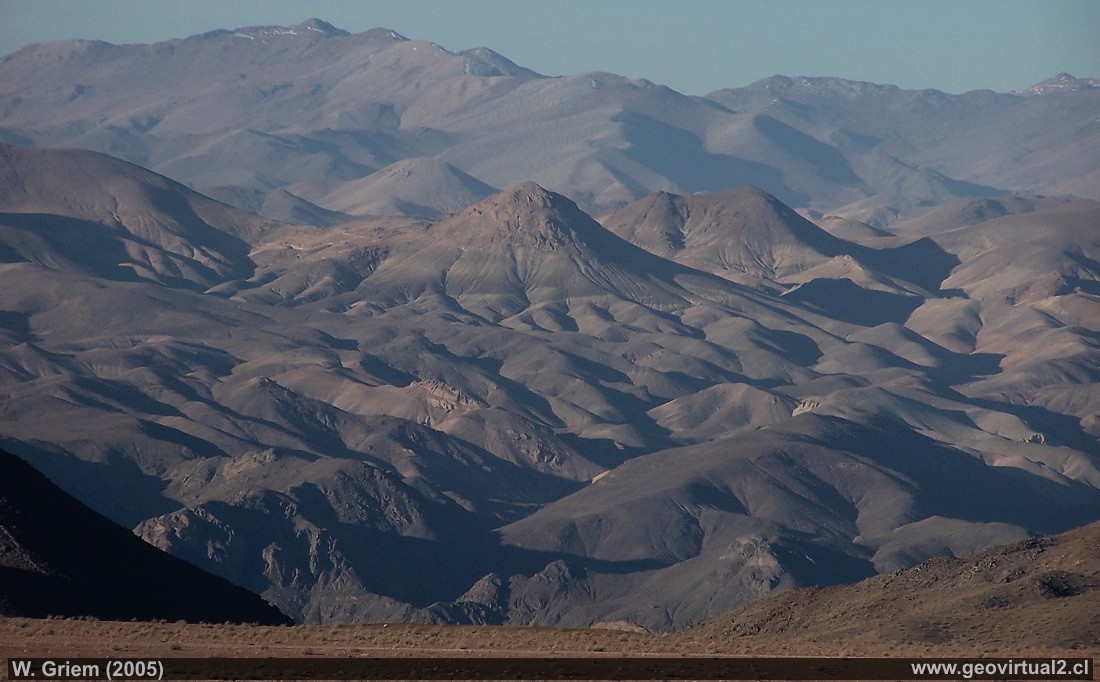
Photo: The precordillera of the Andes between
Los Loros and
Castaño - Atacama Region, Chile.
Photo taken from the road to the silver mines of
Cerro Blanco - view to the east - Copiapó Valley - Qda.
Carrizalillo. Place of viewpoint: The Tirado plain to the east, just
above Los Loros. (Kodak5848; W. Griem 2005)
Road to Cerro Blanco
Description:
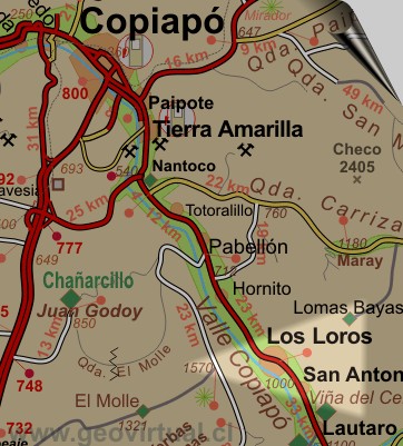
Location: Lomas Bayas is located about 70 km from Copiapo.
Petrol: In Copiapo (70 km) or Tierra Amarilla (55 km)
Road condition: Relatively well gravelled or salted; better with PickUp,
SUV or Jeep.
Worth seeing: Abandoned mining village (silver), desert landscape.
UTM: 400187 / 6927426 - Height: 2025 m.
Information Photo: Kodak
Camera DX6490
Focal length: 55,9,mm (=337/35mm) | Time: 1:750
F: f/5 | Original size: 2304 x 1728 | Date: 2005/06/03/16:55
hrs.
Viewpoint Atacama
Places of interest

Content Viewpoint Atacama
Landscapes of Atacama desert:
Paipote ravine from Llampos
Desde la mina Aguilar
Desert view from Tiro plain
Lomas Bayas hacia Port. Dadin
Cementerio de Lomas Bayas
Pre-cordillera con nieve
La Sierra Peineta
El Salado
Qda. Paredones
Cerros de Merceditas
Leoncito - El Patón
Portezuelo Chinches - Tambaría
Cerro Cadillal o Anselmo
The sector
more information of the Ojos site