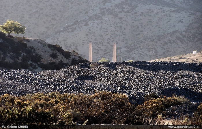
Photo: View of the chimneys of Labrar with a large slag field in the foreground in the region of Atacama (Chile). (Photo W. Griem; 2006; Kodak10606) - (Foto W. Griem; 2006; Kodak10606) - Photo in large size
Information photo: Camera Kodak
DX6490 (100_0606)
Focal length: 31.3mm (=189/35mm) | Shutter speed: 1:180
F: f/3.2 | Original size: 2304 x 1728 | Date of recording:
2006/10/07/18:20 hrs.

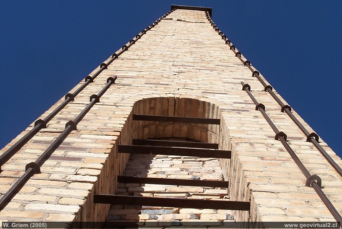
Photo: Chimney of the former copper smelting plant
"Labrar" (region Atacama - Chile). (Photo W. Griem; 2006; K 10553)
Large photo
Information photo: Camera Kodak
DX6490 (100_0553)
Focal length: 8.5mm (=51/35mm) | Shutter speed: 1:350
F: f/6.3 | Original size: 2304 x 1728 | Date of recording:
2006/10/07/17:33 hrs.

Chimneys from Labrar: p.1 | p.2
Labrar was an important industrial complex for the
region. In 1830 Carlos Lambert had a copper smelting plant built in this
area (other sources indicate the year 1846). Even today, three of these
chimneys are still standing vertically in the landscape. They were built
of English clinker and are 18 metres high.
In general, the furnaces were fired with wood or Australian coal. The
port was the "Puerto Peña Blanca"16 kilometres away. In general it is
described that the furnaces were in operation until about 1895, but in
the "Estadística Minera" from 1903 it is reported that at least one
furnace is still in operation and that two more have not been used for a
long time.
There are still a lot of slag in the area today. As an example: In
1903,4,450 tons of copper ore were melted at an average concentration of
14.6%. Approximately 3,000 tons of coal were burned.
In the years 1906 and 1907 a melt with a chimney of 54 feet height
(16,5m) is reported. The tenant, Mr. Marambio had his contract expired
in 1908 to build a new smelting plant several kilometres away. (Yunge,
G. 1909)
Information:
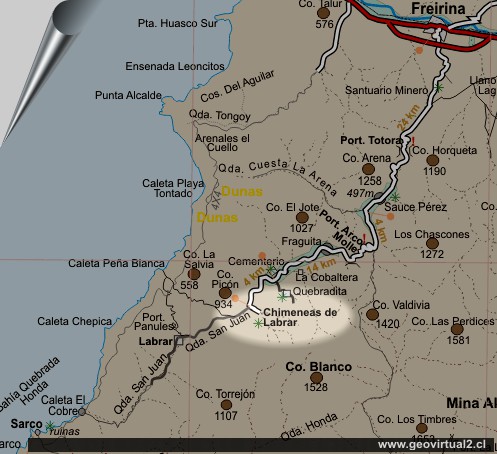
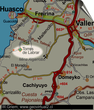
Location: Labrar, Atacama region
Comuna Freirina, Provincia Huasco
Height 635m
Location (UTM): E281.000 / N68.20.163
beeline to Freirina: 29,5 km
Street-kilometre to Freirina: 45,6 km

Chimneys are the most striking witnesses of industrial development, especially in heavy industry. Labrar is one of the few areas where these silent witnesses are still imposingly defying erosion. One should imagine that large areas of the Atacama region used to look like this. Large groups of chimneys with adjoining huts, for example in Tierra Amarilla, Caldera, Yerba Buena, Astillas and many other places. This and the other villages were marked by their active heavy industry, where today the silence of the desert has returned.
The area is a cultural monument! It is forbidden to take any objects with you.
Atacama virtual
Mining Atacama

Introduction to Labrar
Observation platform (km 6,6)
Totora Pass
(km 16,9)
Sauce
Perez (km 22,8)
Loma Suelta
(km 24,0)
Arco Molle Pass
(km 32,5)
Fraguita
(km 35,1)
Kobaltminen
(km 39,3)
Friedhof (km 41,4)
Quebradita (km 44,2)
●
Labrar smelter
(km 45,6)
Other
smelters
Dulcinea
Canto del Agua
Labrar
Higirio
Agua Amarga
Viña del Cerro
Tourist
information
Atacama
Travel instructions
Behavior in the desert
Specific terms
The Andes mountains
Atacama desert
Related pages
Roads of Atacama
Distances between ....
Road
maps
Mining history of Atacama
Atacama landscape
The Atacama desert
Flowering
Atacama desert
Beaches of Atacama
Las Dunas
de Atacama
Others
Railroad history of Atacama
History
of Atacama
Mining history of Atacama
Flora Atacama
Fauna Atacama
Geología Atacama
Climate of the Atacama Region
Atacama desert
Beaches of Atacama
The Andes mountains
Rutas de Atacama
Carretera Panamericana
Aeródromos en Atacama

