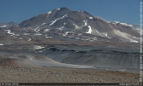
View of the Andes chain from the San Francisco Pass in the Atacama region, Chile
Information about Atacama:
• Population: 285,000 people
• Size: 75.573 km2
• Population density: 3.1 persons / km2
• Elevation: 0m - 6890m
• Region's capital: Copiapó
• Distance from Santiago: 800 km (Copiapó)
• Clima: Desert, semi-desert
• Rainfall: 12 mm/year
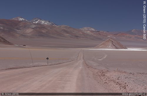
Road in the Andes of Atacama - near the salt flat of Maricunga at 3200 m altitude.
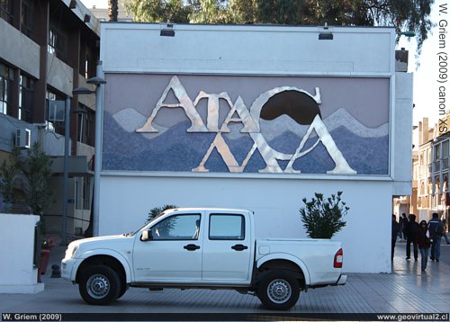
The square of Copiapo - Chile
The Atacama Desert
The Atacama Desert as a tourist destination
The Atacama desert captivates with its unique landscape, the
Andean chain with its striking Stratovolcanoes invites you to extensive
excursions.
The Atacama Desert, Chile, or more precisely the Atacama region, is an
exciting destination for people who want to enjoy a unique landscape.
Here the Andean main chain, the pre-cordillera, the driest desert of the
earth, should serve as references. But also, the historical background
of mining and industrialization can be observed here.
Visitors can
observe the unique, climate-related fauna and flora without any
particular danger in the desert.
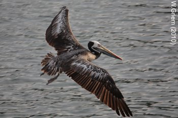
Finally, of course, we have to mention the beach and the
coast. The Atacama Region has various beaches that are not yet connected
to mass tourism but with unforgettable scenery waiting for their
visitors.
The best choice for excursions into the desert is an
off-road vehicle. Often "camionettas" (pick up) or jeeps can be rented
from car rental companies. An SUV is also enough in most cases. The
roads are generally good (asphalt, salt, or gravel) but often a little
lonely or not too frequented. If you follow some safety tips, nothing
can go wrong.
The peak season is between September and April. In
February, almost all of Chile has holidays, which means it can get a
little bit crowded on the coast. In the cordillera, however, this is
hardly noticeable.
Due to the Humboldt current, the water is
relatively fresh (18-19°C). Travelers can explore the Andes from
September to April. In January and February, clouds and rainfall can
occur (Bolivian winter). From May to August, of course, trips are also
very friendly, the temperatures during the day are pleasant, and it is
warm. Only the length of the day is shorter, and nights can get cold.
There are simple, good restaurants in most of the villages and towns of
Atacama. Good restuarnts, which can satisfy higher demands you find in
Copiapó, Vallenar, Bahía Inglesa, Caldera, Huasco, Chañaral. Prices are
moderate, mainly below the European average.
Accommodation is also
available in all major cities.
Some information:
The east-west stretch of the Atacama region at its most extensive point
is about 250 km (airline), the north-south distance at the coast is
about 390 km in the cordillera about 460 km. The surface area is
approximately 75,573.3 km2 (roughly that of Ireland). The highest
elevation is 6842m (Ojos del Salado). With a population density of 3.1
inhabitants on 1 km2, We must address the Atacama region as very
sparsely populated. The amount of precipitation is extremely low (about
12mm/year in Copiapó), the temperatures are similar to the desert
climate: hot during the day (about 31°C in summer), the nights are
remarkably cool (about 12° in summer; in Copiapó).
More information:
Behavior in the desert
Specific terms
Travel instructions
Places of interest
Information about Atacama
●
Atacama
Atacama
Travel instructions
Behavior in the desert
Specific terms
The Andes mountains (I)
The Andes mountains (II)
Atacama desert (1)
Atacama desert (2)
Rains in the Atacama desert
Flowering desert (1)
Flowering desert (2)
Flowering desert (3)
Snow in the Atacama desert (1)
Snow in the Atacama desert (2)
Virtual viewpoint Atacama
Atacama black and white
Road maps of Atacama
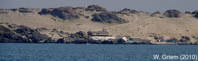
The coast of Atacama
San José
Caleta Punta de Choros
Bahía Carrizalillo
Carrizalillo
Costa de Sarco
Caleta El Cobre
Huasco
Pta. Molle
Carrizal Bajo
Qda Higuera
Sector Gaviotas
Caleta Pajonal
Punta Cachos
Bahía El Salado
Barranquilla
Pampa Cachiyuyal
Playa La Virgen
Puerto Viejo
Isla Chata
Bahía Cisne
Chorrillos
Parque Paleontológico
Rocas Negras /
Las Machas
Bahía Inglesa
Caldera
Ramada
Granito Orbicular
Punta Flamenco
Los Médanos
La Cascada
Chañaral
Pan de Azúcar
Desert & Atacama
Journey to Atacama
Rutas en Atacama
Pan Americana
Distancias de Atacama
Road maps of Atacama
Bibliografía de Atacama
Links, enlaces Atacama
Imágenes 3-dimensionales
Atacama landscape
The Atacama desert
Flowering desert
Beaches of Atacama
History,
Mining at Atacama
Climate of the Atacama Region
Mines and mining in Atacama
The railroad history of Atacama