Photo:
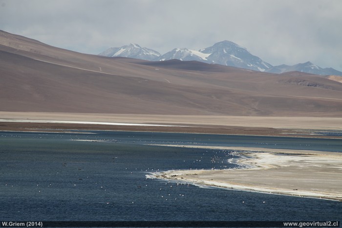
Laguna Negro Francisco Lagoon with Copiapó Volcano.
Foto: W. Griem (2014; -Ca50D34.167)
-
Foto en grande
Photo Information:
Camera Canon 50D
Lens: 18-135mm | Focal length:
18mm (29/35mm) | Time: 1:160 | ISO100
F: f/14 | Original size: 4752 x 3168 | Date: 2014/03/30/16:36 hrs.

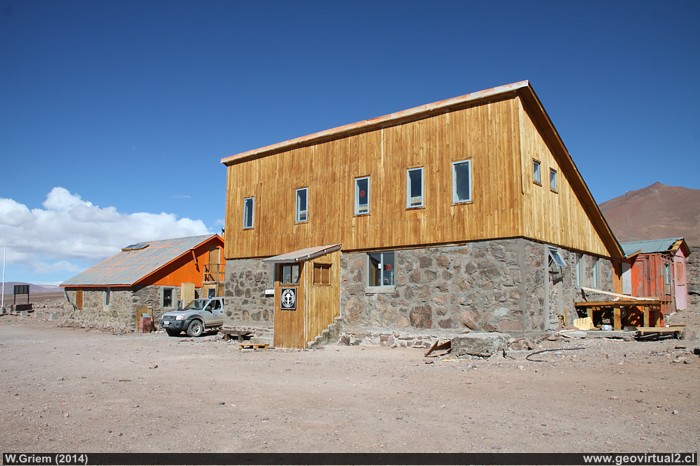
Photo: CONAF Refuge near the Laguna Negro Francisco
Lagoon.
Photo: W. Griem (2014;
Ca50D34.151) -
Photo en grande
Photo Information:
Camera Canon 50D
Lens: 18-135mm | Focal length:
18mm (29/35mm) | Time: 1:160 | ISO100
F: f/13 | Original size: 4752 x 3168 | Date: 2014/03/30/16:17 hrs.
Atacama, Lagoon Negro Francisco: p.1 | p.2
The Negro Francisco
Lagoon
A big lake in the middle of the Chilean highland chain in Atacama. A
very nice excursion destination, with an Andean refuge of the CONAF. In
good weather, you can enjoy a wonderful panorama of the Copiapó volcano
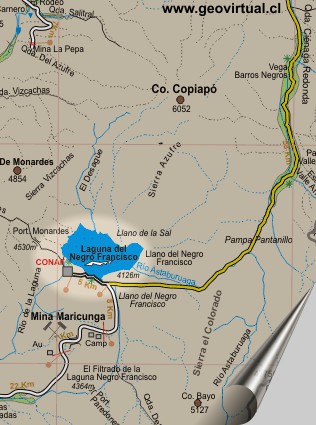
The Laguna Negro Francisco lagoon is 4126 meters above sea level. From
Copiapó by Puquios - Santa Rosa are 228.7 kilometers of road in regular,
perhaps in good condition. Access by Quebrada Carrizalillo - Castaño -
Guardia - Mina Maricunga is a little shorter - only 195.8 kilometers and
generally in good condition (with salt).
La Laguna is noted for its unique landscape. Enclosed of mountains
between 5000 meters to 6000 meters of altitude, with an enormous amount
of animals like Guanacos,
Vicuñas, Flamingos among others.
The lake is a result of the special morphological situation of the
sector. It is a closed basin - no outlet to the ocean. Water from the
rivers Astaburuaga, El Desagüe etc. can only reach the lagoon. Further
north (Maricunga, Pedernales) the salt flats are formed in this way. But
here the precipitation rate is very high, which means that there is a
sufficient amount of water to prevent the salt from crystallizing.
The CONAF Refuge is located in the southern sector of the lagoon. A
solid house with all amenities. There is usually the possibility of
staying overnight, but it is recommended to check beforehand in Copiapó.
| from Laguna Negro Francisco to . . | km |
| Copiapó (over Carrizalillo) | 195 |
| Copiapó (Santa Rosa) | 229 |
| Tierra Amarilla (gasoline) | 180 |
| Laguna Santa Rosa | 82 |
| Policía Int. /Maricunga | 98 |
| Pedernales | 159 |
| El Salvador | 253 |
| Diego de Almagro | 282 |

--
Atacama virtual
Mining Atacama

Intro Carrizalillo - Laguna
El Maray (km 48,9)
Cabeza de Vaca (km 51,9)
Port. Castaño (km 90,8)
La Guardia (km 120,4)
Vega Colorada (Km 137,0)
Qda. Paredones (Km 154,4)
►
Lag. N. Francisco (Km 194,7)
Intro Camino Internacional
Chulo (km 24,3)
Puquios (km 57,5)
La Baritina (km 67,7)
La Puerta (km 75,0)
Vegas Las Juntas
(km 123)
Port. Maricunga (km 140)
Lag. Santa Rosa (Km 147)
►
Lag. N. Francisco (km 229)
*km desde Copiapó (Lider)
Nearby and more
Maricunga
salt flat
The Andes mountains
Atacama desert
Related pages
Roads of Atacama
Distances between ....
Road
maps
Mining history of Atacama
Tourist
information
Atacama
Travel instructions
Behavior in the desert
Specific terms
The Andes mountains
Atacama desert

