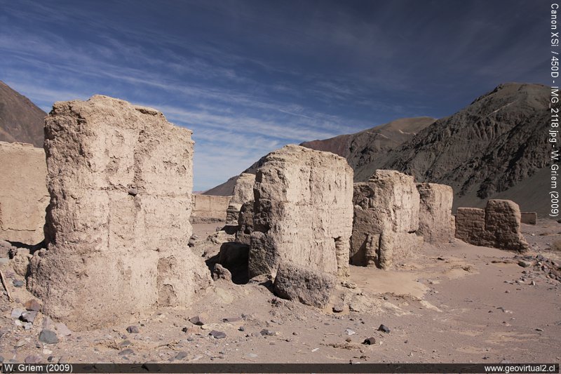
Photo: Ruins of Puquios in the Atacama Region - Chile. (Photo W. Griem 2009; CaXSi-2118) - Large photo
Photo Information: Canon XSi Camera
Lens: 17-70mm (pol) | Focal length: 23mm | Time: 1:160 | ISO100
F: f/7.1 | Original size: 4272 x 2848 | Date: 2009/07/09/12:53hrs.

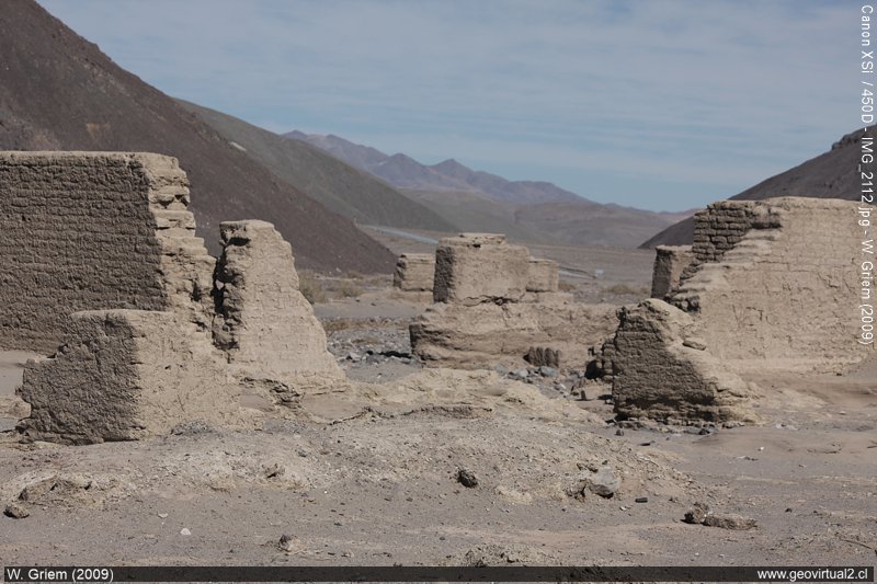
Photo: Ruins of Puquios in the Atacama Region - Chile. (W. Griem 2009; CaXSi-2112) - Large Photo
Photo Information: Canon XSi Camera
Lens: 55-250mm | Focal Length: 79mm | Time: 1:160 | ISO100
F: f/7.1 | Original size: 4272 x 2848 | Date: 2009/07/09/12:48hrs.

Puquios: p. 1 - p. 2 - p. 3 - p. 4 - Railroad - Sofía Mine
The ruins of Puquios:
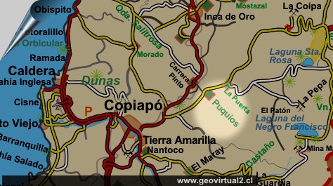
We will get to The Puquios' ruins (Region of Atacama, Chile) in the
pre-Cordillera range, some 60 km east of
Copiapó.
Puquios was a mining town with more than 5000 inhabitants, a railway
station, and some well-built houses. From the 1930s onwards, the miners
left this site. Today we see the remains of houses, industrial plants,
and the cemetery [here].
The inhabitants built the houses mainly with adobe bricks, and we
can still imagine the last century's design. Puquios was connected to
the railway of Caldera - Copiapó [here].
Its location near mining sectors such as Dulcinea and
Tres Puntas
ensured a specific development. Guillermo Wheelwright projected from
Puquios a railway line to Argentina. The fall of mining at the turn of
the century, financing problems, and topographical difficulties did not
allow this project.
According to
Espinoza (1895), 626 people live in
Puquios in the same year of the publication.
See also "Snow in Puquios and Quebrada Paipote". [here]
Location (UTM): 411969E / 6995828 N
datum prov. South America 1956
Place: Ruins of
Puquios, Atacama Region
Atacama Region, Chile
Province of Copiapó
Commune of Copiapó
Location: UTM: 411.969E / 69.95.828 N (Datum prov. SudAm. 1956)
Population: 0
Height: 1248 m
Distance to Copiapó: 57,5 km
Places of interest
Information about Atacama

Intro Camino
Internacional
Chulo (km 24,3)
►Puquios (km 57,5)
Empalme La Puerta (km 75,0)
El Salto
(km 80,4)
San Andrés (km
90)
Majada Andrés (km 96,6)
Azufrera (km 141,9)
Port. Codocedo (km 150,1)
Salar
Maricunga (km 167,5)
Qda. Ciénaga Redondo
Pantanillo
Laguna N. Francisco
Río Lama (km 198,5)
Cascada Río Lama (km 199,5)
Llano Piedra Pómez
Barrancas Blancas (km 240,0)
Ex. Hostal Muray
Ojos del Salado
(engl.) (km 244,2)
Laguna Verde
(engl.) (km 256,6)
Incahuasi
Paso San Francisco (km 276,9
Related pages
Roads of Atacama
Distances between ....
Road
maps
Mining history of Atacama
Tourist
information
Atacama
Travel instructions
Behavior in the desert
Specific terms
The Andes mountains
Atacama desert
Other units
Atacama black and white
Virtual viewpoint Atacama
Collection of Books
Atacama black and white
Puquios


