Content
Town
Streets
Information
Timeline
Documents
Yesterday and today
Text
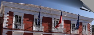
The town
La Plaza (town square)
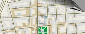
Streets of the centre
Centro Coimbra
Chapel of Candelaria
Streets of Copiapó
Calle O´Higgins /
Calle Chañarcillo
Infante /
Rodríguez
Atacama /
Los Carreras
General information
Hotels and accommodation
Restaurants
Museums
Regional Museum
Mineralógical Museum
Ex-Museo del Ferrocarril
Life
Festivities of Candelaria
Cultur in the square
Anniversary of Copiapó
Shop "El Botón"
Shop "El Herrerito"
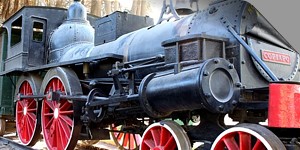
Railroads of Copiapó
Copiapo railway station
Copiapo railway station (Historic documents)
Burmeister: Pabellón - Copiapó
Steam locomotive La Copiapó
Line at Carreras
Old centre line (Carreras)
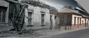
Copiapó today and yesterday ....
a comparison
Atacama street 1989 / 2005
O'Higgins street - Gana
O'Higgins street - Corona (2005 - 2010)
House at Atacama street (1997 / 2005)
La Alameda (1989 / 2004)
O´Higgins street near la Plaza
Carreras street 1922 y 2005
Carreras street with Maipú (1989/2005)
Pan-Americana near the Universidad
Chacabuco street to Atacama street
Los Carreras street / Bavaria (1990/2005)
Copiapó from Cerro La Cruz (1989
/ 1997)
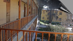
Mining school of Copiapo
La UDA
Salas históricas ("B")
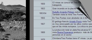
Timeline of the mining school
Historical photo of Mining school
Pan-American Motorway near UDA
Historical Records
Historical texts
Charles Darwin about Copiapó (1835)
Domeyko about Copiapó (1840)
Paul Treutler about Copiapó (1851)
Center of Copiapó (by Treutler (1851)
Education in Copiapó (Gilliss, 1852)
Philippi about Copiapó (1853)
Burmeister: Earthquake
of
Copiapó (1859/60)
Pérez Rosales about Copiapó
(1859)
Tornero about Copiapó (1872)
Hugo Kunz about Copiapó (1890)
Enrique Espinoza - Copiapó (1903)
Ramírez, 1932
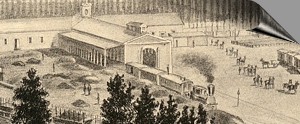
Images of the past
Chañarcillo street, R. Tornero (1872)
Atacama Street, Bowman, 1913
Theatre of Copiapó (1913)
Plaza of Copiapó de R. Tornero (1872)
Overview at Copiapó, R. Tornero (1872)
Plaza of Copiapó, R.A. Philippi (1860)
Overview Copiapó, Paul Treutler 1854
Photo aerial 1937 La Chimba
Railroad station of Copiapó
Photo aerial, railroad station 1937
Mining school of Copiapo at 1934
Bodega lake (1910)
Map of Copiapó (1892)
Map Copiapó 1920
Informative Chart
● Place: Copiapó
● The capital of the Atacama Region
● UTM Location: E368.240 / N69.72.260
● Altitude: 390 m
● Distance: 806 km north of Santiago
● Population: 162,000 (2012)
Copiapó:
Copiapó is the capital of the Atacama Region, located in the north of
Chile. With 162,000 inhabitants, the city is located about 70 kilometers
inland in the fertile Copiapo Valley and is also the heart of an
important mining center in South America: copper, silver, gold and iron
are the most important raw materials mined here.
The history of Copiapo goes back to pre-Spanish times, the Copiapo
Valley was inhabited by pre-Spanish cultures for a long time. Around
1832, large silver deposits were discovered and developed; around 1870,
Copiapó was one of the largest silver producers in South America. At the
same time as copper and gold mining, a considerable wealth moved into
the small desert town. The rapid industrial development was also
reflected in technical progress: the first railway from Caldera to
Copiapó, deep-sea cables, mining school, street lighting and a variety
of innovations quickly reached Copiapo. Around 1900 the silver mining
industry was extinguished, and copper mining was also severely reduced.
Only in the fifties the copper industry recovered and to this day it is
one of the main sources of the region and the country.
Today Copiapó is a small town, you can still see its rich history, but
there is still an atmosphere of the fifties in some streets.
Copiapó offers accommodation for every budget: from cheap residences to
exclusive hotels. Restaurants of all price ranges can also be found
everywhere. Museums, cafés, the Plaza and many other places invite you
to visit. Copiapó can also be chosen as the starting point for many
Andean tours.
So why Copiapó? I'm going to say . . .
Copiapó has always been a city where people produce silver, copper, gold
and grapes. Copiapó may not be beautiful - but it is certainly
interesting, Copiapó is authentic. The streets of the city grew with the
mining industry. Unfortunately, the economic development in the mining
industry is never straightforward - this can be seen very clearly in the
inner city area of Copiapó. Houses of the noblest kind built perhaps 150
years ago are now facing decay - if they are not restored for reasons of
monument protection.
In Copiapó, we can look back on an era which unfortunately can hardly be
observed in other places. It is worthwhile to hike the side streets in
the inner city area with your eyes wide open and to explore the
different phases of urban development. The once glamorous buildings of
the rich citizens of the "Tres Puntas" or "Chañarcillo" period
(1840-1890). The buildings in Art Nouveau and Bauhaus style from 1920 to
1950, as well as the architectural building sins from the 1960s
and 1970s, which are also part of the development.
Places of interest
Information about Atacama
Towns of Atacama
Introduce tourist sites
Copiapó
Vallenar
El Salvador
Chañaral
Caldera
Diego de Almagro
Huasco
Freirina
Alto del Carmen
Tierra Amarilla
| Distances: | |
| from Copiapó | km |
| Copiapó | 0,0 km |
| Caldera | 75 km |
| Chañaral | 167 km |
| El Salvador | 203 km |
| Vallenar | 145 km |
| more . . | |
| www.geovirtual2.cl | |
Tourist
information
Atacama
Travel instructions
Behavior in the desert
Specific terms
The Andes mountains
Atacama desert
Maricunga
salt flat
The Andes mountains
Atacama desert
Otros
Ferrocarriles Atacama
Mining history of Atacama
Historia de Atacama
Flora Atacama
Fauna Atacama
Geología
Atacama
Clima Atacama
Desierto de Atacama
Playas en Atacama
Cordillera de los Andes
Rutas de Atacama
Carretera Panamericana
Aeródromos en Atacama
Related pages
Roads of Atacama
Distances between ....
Road
maps
Mining history of Atacama

