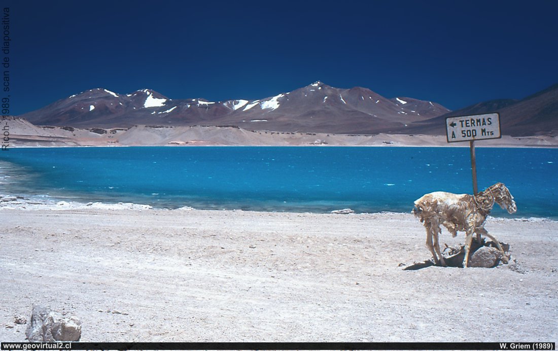
Photo of the Laguna Verde at 4328m altitude - Atacama Region, Chile. (W. Griem, 1989/1990): It should be remembered that in 1989 the trip to this sector was a real adventure. De Copiapó easily traveled two days. Large photo
Information Photo:
Camera Ricoh KR-10x | Longitud focal: s/i +pol.|
Tiempo: s/i
Tamaño original: 35mm | Fecha: 1990

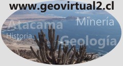
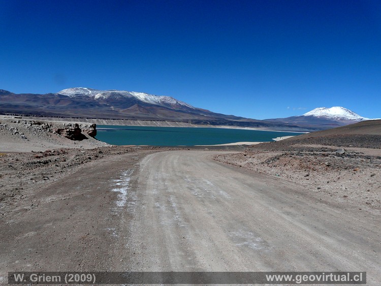
Photo of Laguna Verde in the vicinity of Paso San Francisco, which joins Atacama with Argentina. (W. Griem 2010 Ca50D-3289; - Large photo
Información Foto:
Cámara Canon 50D | Lente:20mm +pol.| Longitud focal:
20mm | Tiempo: 1:320 | ISO100
F: f/5,6 | Tamaño original: 4752 x 3168 | Fecha:
2010/09/16/13:59hrs.
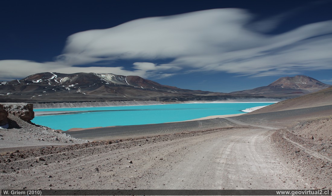
The Andean chain: Laguna Verde
At the foot of the high cordillera is the beautiful
Laguna Verde. On quiet days, the mountains' peaks, which are over 6000 m
high, are reflected in the green-blue water. A hot water source provides
pleasant water temperatures in a limited area.
The Laguna Verde is
4200 m above sea level. Therefore, the visitors should take all
precautions against altitude sickness into account.
The lake
serves as a base station for high-mountain tours, especially to the Ojos
del Salado.
Location Data:
UTM: E551.308 / N70.25.935
Elevation: 4350m
Distancia to Copiapó (cam. Inter.): 256 km
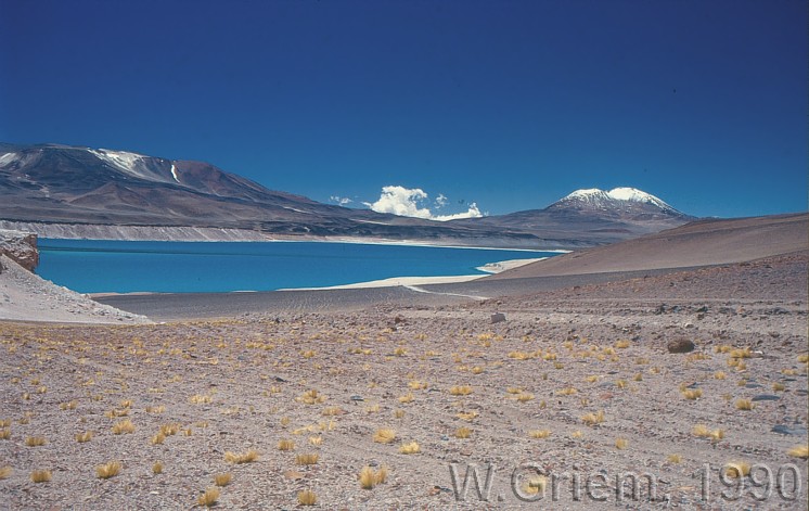
The whole area around Laguna Verde has an elevation of
more than 4200 meters. You have to move carefully if the body hasn't yet
adapted to this height.
This sector is used to initiate several
excursions to the mountain range, especially to Ojos del Salado (only
for people in physical conditions able to withstand the lack of oxygen).
The same photo large scale: 1990
Photo of the year 2009. Large scale (P7723)
Places of interest
Information about Atacama
Intro Camino Internacional
Chulo (km 24,3)
Puquios(km 57,5)
Empalme La Puerta (km 75,0)
El Salto
(km 80,4)
San Andrés
(km 90)
Majada Andrés (km 96,6)
Azufrera (km 141,9)
Port. Codocedo (km 150,1)
Maricunga
salt flat
(km 167,5)
Río Lama (km 198,5)
Cascada Río Lama (km 199,5)
Llano Piedra Pómez
Barrancas Blancas (km 240,0)
Ex. Hostal Muray
Ojos del Salado (km 244,2)
►Laguna
Verde (km 256,6)
Incahuasi
Paso San Francisco (km 276,9
Nearby and more
Santa Rosa lake
Laguna Verde (engl.)
Río Lama
The Andes mountains
Atacama desert
Related pages
Roads of Atacama
Distances between ....
Road
maps
Mining history of Atacama
Mapa histórica del sector (Bertrand, 1885)
Tourist
information
Atacama
Travel instructions
Behavior in the desert
Specific terms
The Andes mountains
Atacama desert
Other units
Atacama black and white
Virtual vantage point to the Desert
Collection of Books

