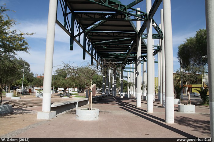
Foto: Plaza, Town square of Diego de Almagro (W.Griem, 2012;
Ca50D1602)
Photo large size
Photo Information :
Camera Canon 50D
Lens: 17-70mm | Focal length: 17mm (=27,5/35mm)
| Time: 1:250 | ISO100
F: f/9 | Original size: 4752 x 3168 | Date: 2012/02/08/17:09 hrs.

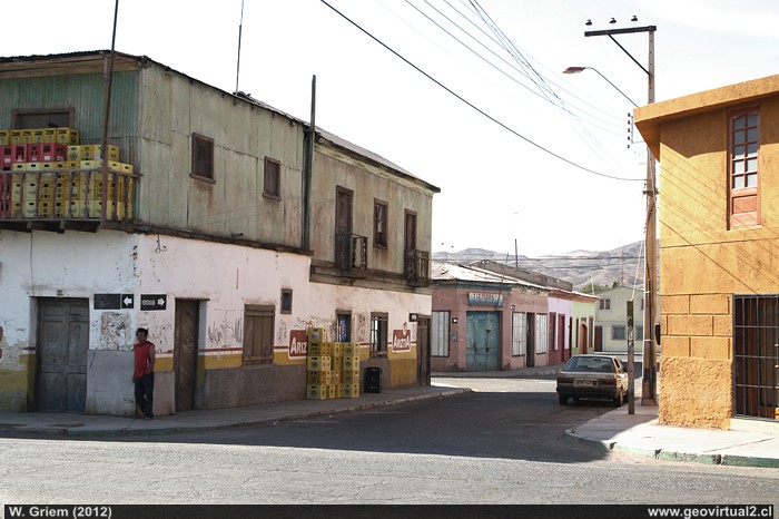
Photo: House in the centre of Diego de Almagro (W. Griem, 2012;
Ca50D1664)
Large Photo
Photo Information:
Camera Canon 50D
Lens: 17-70mm | Focal length: 33mm (=52,8/35mm)
| Time: 1:160 | ISO100
F: f/9 | Original size: 4752 x 3168 | Date: 2012/02/08/17:37 hrs.

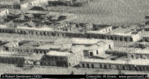
Photo by Robert Gerstmann at 1932: The same houses like above, but without crates of beer . Photo in large, in section: Illustrations from Chile and Atacama
Diego de Almagro: p.1 │ p.2│ p.3 │ FFCC
"Pueblo Hundido" ("Sunken Town") was formed by the
mining activities of the sector and as the last oasis before the
deserted "despoblado" Atacama. The name "Sunken Town" (Pueblo Hundido)
probably comes from a natural disaster. Bishop Rafael Valentín
Valdivieso reported a natural catastrophe, with trees overturned and
buried and open cracks. The descriptions seem to be a great mudflow that
obviously buried parts of a mythical village, at least buried large
amounts of vegetation in the area. Climatic conditions, geomorphology
and the drainage system could confirm this fact.
The social life of Pueblo Hundido between 1900 and 1950 looked like a
screenplay for a western film: The gang of the pisqueros secured the
supply of alcohol inside the mining companies (alcoholic beverages were
-as they are today- totally forbidden inside a mining site). This group
with their emblematic figures did not enter into verbal discussions with
authorities or other gangs......
Espinoza (1895) indicates that in
Pueblo Hundido about 265 people lived in 1895. In that year, the railway
line only reached "El Salado". But the people have already converted the
village to a major mining center. It is worth mentioning that in those
times "Pueblo Hundido" was the closest town to the borax deposits of the
Salar de Pedernales.
Places of interest
Information about Atacama

Routs of Atacama
Intro camino a Pedernales
►
Diego de Almagro
(km 0,0)
Río El Salado (Km 15,0)
The Pedernales salt flat (Km 112)
Maricunga
salt flat (Km 179)
Intro Ruta Altamira
►
Diego de Almagro
(km 0,0)
Mirador Pampa Aust.(Km 13,8)
Altamira (Km 77,5)
Agua Verde (Km 139)
The railroad history of Atacama
Estación FFCC Diego
Mining history of Atacama
Mining districts of Atacama
Mina Alaska
Minas de Inca de Oro
Near
The Pedernales salt flat
Maricunga
salt flat
The nitrates
Inca de Oro
El Salado
Finca
Chañaral Alto
Qda. Chañaral Alto
Lavaderos en el río El Salado
El Salvador
Potrerillos
Chañaral
Mapa del sector
Information
General data Atacama
Distances in Atacama
Books of Atacama
Collection of Books
Road - maps
Tourist
information
Atacama
Travel instructions
Behavior in the desert
Specific terms
The Andes mountains
Atacama desert

