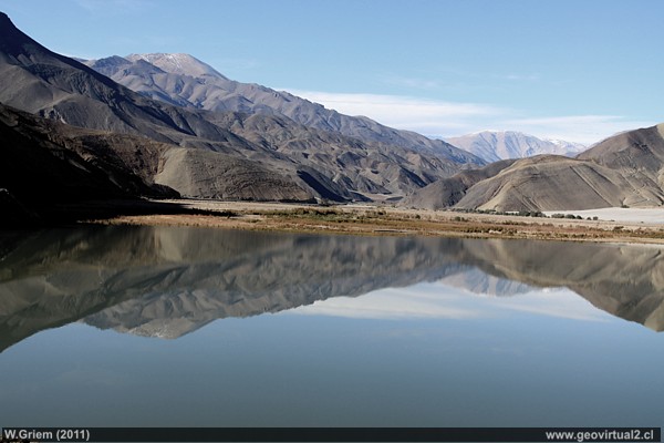
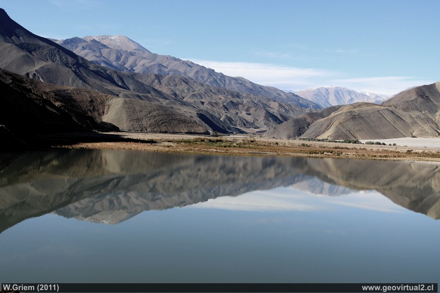
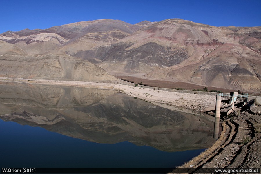
Photo: Lautaro Reservoir - view from the dam to the south, Atacama Region - Chile: Absolute calm can only be expected in the early morning hours - than the surface of the water is a true mirror. (W. Griem, 2011, Ca50D-7676) Foto grande
Photo Information:
Camera Canon 50D | Lens: 18-200mm | Focal length:
32mm | Time: 1:160 | ISO100
F: f/9 | Original size: 4752 x 3168 | Date: 2011/07/17/10:59 hrs.
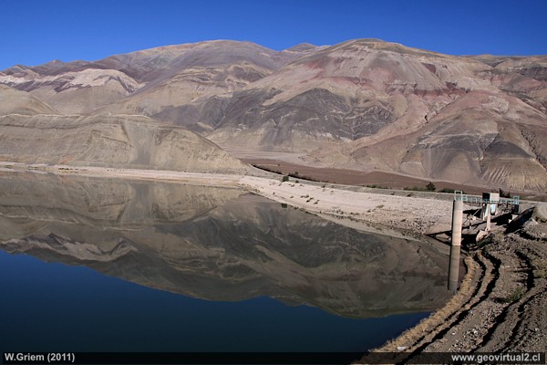
Photo: Lautaro reservoir; Atacama Region - Chile: Rocks colored by hydrothermal alterations give the sector a special note (W. Griem, 2011, Ca50D-7682) - Foto grande
Photo Information:
Camera Canon 50D | Lens: 18-200mm | Focal length:
20mm | Time: 1:320 | ISO100
F: f/9 | Original size: 4752 x 3168 | Date: 2011/07/17/11:00 hrs.
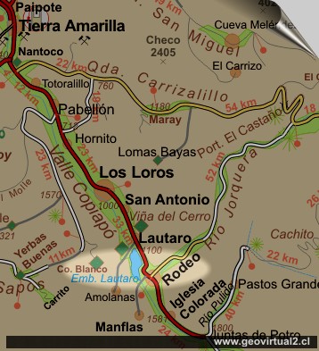
Atacama - Lautaro Reservoir
Tranque Lautaro -
Lautaro Reservoir:
Built in 1930 to ensure water supply in the Copiapó Valley and to
eliminate probable flooding after heavy rainfall. The gate is located at
1130 meters high and captures the waters of the rivers Potro, Manflas,
Jorquera, Chacay, Vizcachas del Pulido (or simply "Pulido") and Río
Ramadillas.
Especially in river systems with high variability of their flow rate
during the year reservoirs are a good measure to regulate the flow of
water, specifically achieved a leveling of the flow rate throughout the
year.
The disadvantages are the high rate of evaporation of water in the
reservoir (especially in arid zones), consumption of landscape, the
productive base of the valley disappears under the reservoir forever. In
addition, the ecosystem downstream of the reservoir will be changed
considerably due to the lack of replenishment of new sediments.
The last one, the sediments carried in the river water are one of the
biggest problems in the reservoirs: due to the slower flow velocity,
sedimentary load accumulates at the bottom of the reservoir. The
reservoir is filled with sediment over decades and loses its original
capacity. This phenomenon is more important in river environments
defined by high variations of sporadic flows. Erosion and particle
transport are increased in these sporadic events considerably. The other
thing that can increase the load of suspended sediment in a river
considerably is of course the lack of vegetation.
Places of interest
Information about Atacama

Intro valle Río Copiapó
Copiapó (Km 0,0)
Tierra Amarilla (km 15,7)
Nantoco (Km 22,2)
Sector Nantoco
The Copiapó river
-
a Cerro Blanco
Punta Brava (Km 53,7)
Los Loros (Km 62,3)
San Antonio (Km 70,1)
Smelter Inka (Km 74,0)
Aqueduct
Amolanas (Km 82,2)
►
Lautaro reservoir
(Km 84,2)
Iglesia Colorada (Km 110,1)
Río Montosa (Km 115,4)
Junta de Potros (Km 118,9)
La Semilla
Pastos Grandes (Km 137,1)
Qda. Pircas Coloradas (146,1)
Port. Cachitos (Km 167,1)
Río Turbio (Km 194,5)
Del sector
FFCC Copiapó - San Antonio
Mapa del sector
GILLISS excursion Come Caballo
Related pages
Roads of Atacama
Distances between ....
Road
maps
Mining history of Atacama
Tourist
information
Atacama
Travel instructions
Behavior in the desert
Specific terms
The Andes mountains
Atacama desert

