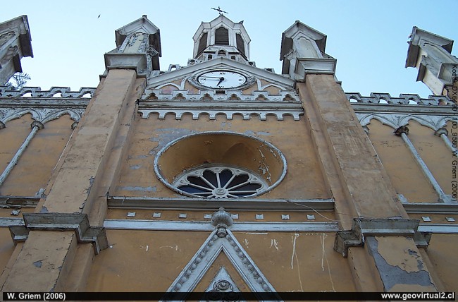
Photo: Church of Tierra Amarilla; Atacama Region - Chile. (W. Griem, 2006; Kodak9580) - Large Photo
Information Photo:
Camera Kodak DX6490 | Focal length: 6,3 mm | Shutter speed:
1:125
F: f/3.2 | Original size: 2304 x 1728 | Date: 2006/06/28/8:55 hrs.

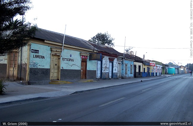
Photo: Tierra Amarilla Main Street; Atacama Region, Chile. (W. Griem, 2006; Kodak9588) Large Photo
Photo Information:
Camera Kodak DX6490 | Focal length: 6,3mm | Shutter speed:
1:125
F: f/3.6 | Original size: 2304 x 1728 | Date: 2006/06/28/8:59 hrs.
Tierra Amarilla: p.1 | p. 2 | p. 3 | p. 4
Tierra Amarilla
(means: Yellow Earth)
Tierra Amarilla is located some 20 km south of Copiapó. It has been a
mining center for many years and preserves a very particular mining
style in its streets. A beautiful square, shops, bars and restaurants
invite you to relax.
Introduction, location:
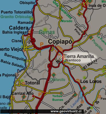
Tierra Amarilla is located about 20 kilometers southeast of Copiapó. It
is a city with a long mining history located in the Copiapó River valley
near several important copper deposits. The Candelaria Mine, Punta de
Cobre and Ojos del Salado Mine are currently to be named.
A stroll through Tierra Amarilla is probably the best way to understand
the beginning of the industrialization era in Atacama.
The neo-Gothic church was built in 1904. It is located in the center, in
front of the square.
Informative table:
Location: Tierra Amarilla, Atacama Region
Comuna Tierra Amarilla, Province of Copiapo
Height 497m
Location (UTM): E374944 / N69.59.624
Aerial distance to Copiapó: 14,3 km
Distance from Copiapó road: 15,7 km
13,507 inhabitants (2012) according to INE
Tourist landmarks:
Mining Museum
Museum open air Mina Transito
Church

General description:
The main axis of Tierra Amarilla is the road that reaches the valley of
the Copiapó River. Close to the church and the square you can find
shops, stores, petrol station, bars and restaurants. The mining history
of the small town is strongly visible throughout the downtown area. The
urban development was clearly oriented along the axis of the road into
the valley.
Places of interest
Information about Atacama

Intro valle Río Copiapó
Copiapó (Km 0,0)
►Tierra
Amarilla (km 15,7)
Nantoco (Km 22,2)
Sector Nantoco
The Copiapó river
-
a Cerro Blanco
Punta Brava (Km 53,7)
Los Loros (Km 62,3)
San Antonio (Km 70,1)
Smelter Inka (Km 74,0)
Aqueduct
Amolanas (Km 82,2)
Reservoir Lautaro (Km 84,2)
Iglesia Colorada (Km 110,1)
Río Montosa (Km 115,4)
Junta de Potros (Km 118,9)
La Semilla
Pastos Grandes (Km 137,1)
Qda. Pircas Coloradas (146,1)
Port. Cachitos (Km 167,1)
Río Turbio (Km 194,5)
Area
FFCC Copiapó - San Antonio
Atacama en b/n Tierra Amarilla
Qda. Carrizalillo
Valle Copiapó abajo
Mapa del sector
Sector en 3D
GILLISS excursion Come Caballo
Related pages
GILLISS excursion Come Caballo
The Andes mountains
Atacama desert
History
of Atacama
Mining history of Atacama
Pages of interest
The railroad history of Atacama
Mining history of Atacama
History
of Atacama
Virtual vantage point to the Desert
Vida Atacama en b/n

