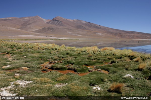
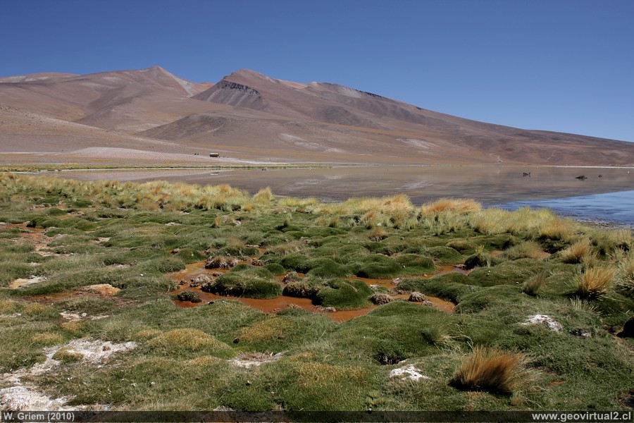
Photo: Santa Rosa Lake with CONAF refuge in the background; Atacama Region - Chile. (W.Griem, 2010; CaXSi9780) Large photo
Photo Information:
Camera Canon XSi | Lens: 20mm | Focal length:
20mm | Time: 1:160 | ISO100
F: f/5.6 | Original size: 4272 x 2848 | Date:
2010/02/08/11:27hrs.
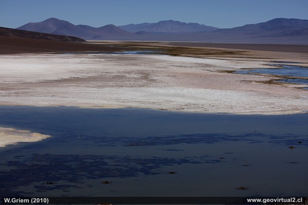
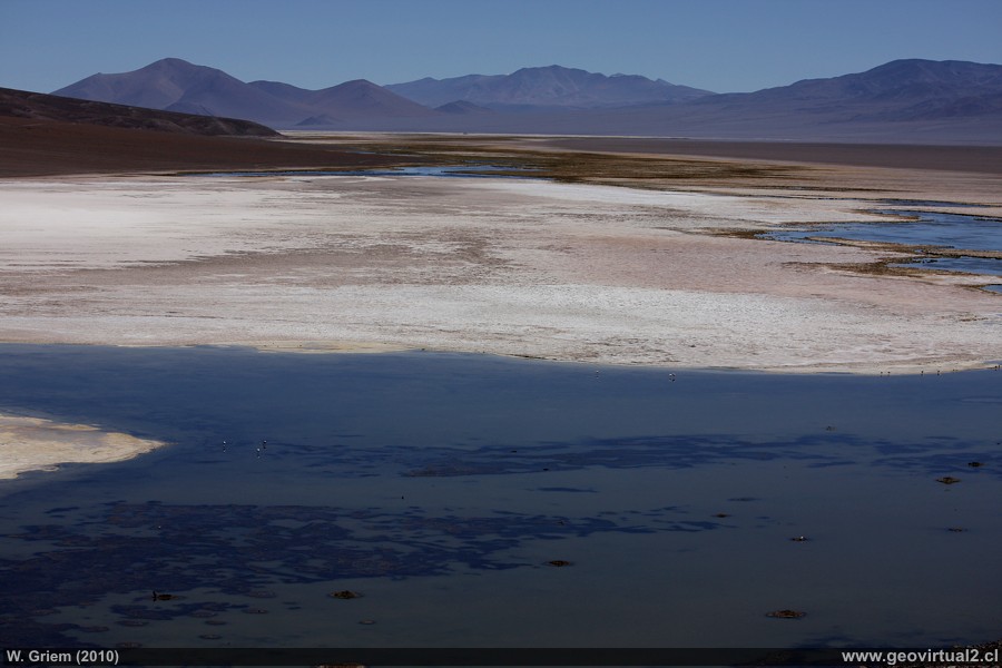
Photo: View from the viewpoint of Santa Rosa Lake and Maricunga Salt
flat; Atacama Region - Chile. (W. Griem, 2010;
CaXSi
9820)
Large photo
Information Foto:
Camera Canon XSi | Lens: 55-250mm | Focal length:
55mm | Time: 1:1600 | ISO100
F: f/7.1 | Original size: 4272 x 2848 | Date:
2010/02/08/12:00hrs.
Atacama, Lake Santa Rosa: p.1 | p.2 | p.3
Especially in the mornings you can enjoy the optimal conditions to take pictures. With the lack of mist and wind, a spectacular panoramic view opens up. The western shore of the sector is characterized by its pastures entering the clean water. A shelter for all types of birds in the sector.
Cuadro Informativo
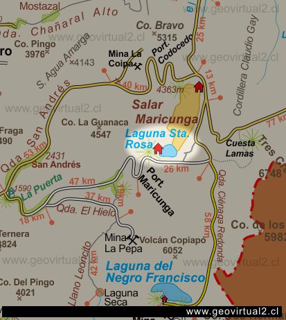
Lake Santa Rosa
Location of the site: E 482.925 / N 7004.361 (Pr.S.A.1956)
Elevation: 3762 m
Distance to Copiapó: 152,6 km
Travel time to: 2 hrs. 50 min.
Places of interest
Information about Atacama
Intro Camino Internacional
Chulo (km 24,3)
Puquios (km 57,5)
La Baritina (km 67,7)
Empalme La Puerta (km 75,0)
La Puerta (km 81)
El Escorial (Km 86,4)
Vegas Las Juntas (km 123)
Port. Maricunga (km 140)
►
Lag. Santa Rosa
(Km 147)
Llano Ciénaga Red. (km 158)
Qda. Ciénaga Red. (km 207)
Pantanillo (km 216)
Laguna N. Francisco (km 229)
Nearby and more
Maricunga
salt flat
Río Lama
The Andes mountains
Atacama desert
Related pages
Roads of Atacama
Distances between ....
Road
maps
Mining history of Atacama
Tourist
information
Atacama
Travel instructions
Behavior in the desert
Specific terms
The Andes mountains
Atacama desert
Other units
Atacama black and white
Virtual vantage point to the Desert
Collection of Books

