Content
Information
Cachiyuyo today
Historical Resources
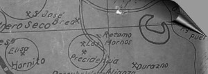
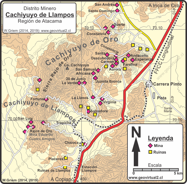
Map of Cachiyuyo
page +
Informative Chart
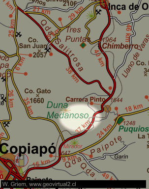
Location: District Cachiyuyo de Llampos
Commune Copiapó
UTM Location: E 399.500 / N69.94.300
Height: 1300 m - 2300 m
Location: (direct line) 38.5 km in N53E from Copiapó.
Road: 48 kms from Copiapó
Condition: Activity of small scale mining, prospecting and some
abandoned mines.
Mineralization: Au (Cu), Tourmaline, Quartz, Wulfenite, Lindgrenite
The mining district of Cachiyuyo is subdivided
into Cachiyuyo de Llampos and Cachiyuyo de Oro. It is a very
heterogeneous mining district, with the north longitudinal railway line
as its axis of infrastructure, although its construction in 1909 was
quite young compared to active mines. Paul Treutler mentions mining in
the sector (1853) and also mentions Inca mining activities.
The mining statistics in 1869 indicate a production of 146,074 kg of
fine gold (per year 1869). We worked in 6 to 11 mines with a maximum of
223 people (January). The average grade in gold reached 145 ppm (or
g/ton); not so bad. Most of the gold comes from the vein of the mine:
Diana, Constancia, Descubridora
and
Carmen.
Places:
Ruins of the village Llampos
Railway station of Llampos
Historical roads
The mines:
Andacollo mine
Carmen mine
Virginia mine
La Verde mine
Rajo de Oro mine

Historical texts
Lorenzo Sundt - Andacollo
Paul Treutler - Minas de Cachiyuyo y Crisis de cobre
San Roman en Cachiyuyo
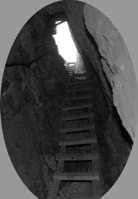
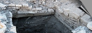
Photo: Interior of
the Rajo de Oro mine
Mining Atacama
Journey to Atacama

español - deutsch - english
Mining Atacama:
Content Mining Atacama
List
of mining districts Atacama
Mining from 1830 to 1920
Chañarcillo
Tres Puntas
district
Cerro Blanco
district
Lomas Bayas
district
Agua Amarga
Distrito Inca de Oro
Puquios - Carrera Pinto
►
Cachiyuyo de Llampos
Carrizal Alto
Cabeza de Vaca - Maray
Checo de Cobre
más lugares ...
Surroundings
Inca de Oro (village)
Llano de Varas
Ruta Copiapó - Diego de Almagro
Estación FFCC Chimbero
Desierto Atacama Tres Puntas
Others
Railroad history of Atacama
History
of Atacama
Mining history of Atacama
Flora Atacama
Animals of the Atacama Desert
Geología Atacama
Climate of the Atacama Region
Atacama desert
Beaches of Atacama
The Andes mountains
Rutas de Atacama
Carretera Panamericana
Aeródromos en Atacama
Tourist
information
Atacama
Travel instructions
Behavior in the desert
Specific terms
The Andes mountains
Atacama desert
