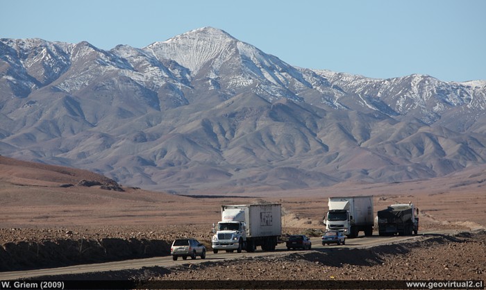
Photo: Cachiyuyo hills between Llampos and Carrera Pinto, Atacama Region - Chile. (Foto W. Griem 2009; CaXSi3291) Foto en grande
Información Foto:
Cámara Canon XSi
Lente: 55-250mm | Longitud focal:200mm (=323/35mm
| Tiempo: 1:400 | ISO100
F: f/8 | Tamaño original: 4272 x 2848 | Fecha: 2009/07/22/15:31hrs.

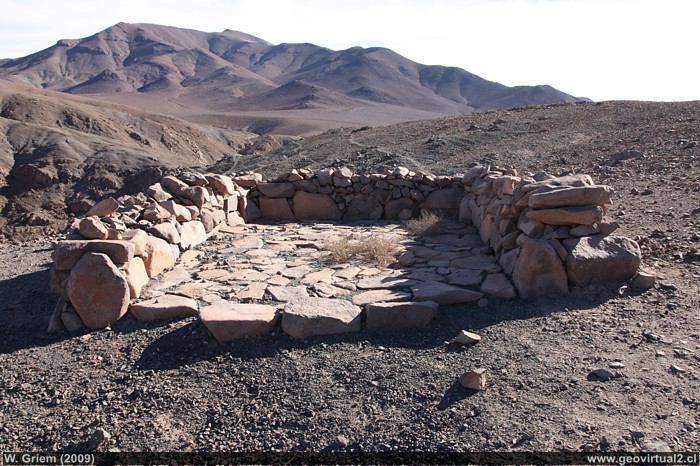
Photo: Ruins of a mining site - mine, field and a small foundry in Llampos, Atacama Region - Chile. (Foto W. Griem 2009; CaXSi2222) - Foto en grande
Information Photo:
Camera Canon XSi
Lente: 17-70mm | Longitud focal:21mm (=34,4/35mm
| Tiempo: 1:160 | ISO100
F: f/11 | Tamaño original: 4272 x 2848 | Fecha: 2009/07/10/10:20hrs.
The paved road between the viewpoint and Llampos
continues to climb strongly, although the inclination is hardly
noticeable visually. The road follows roughly the old longitudinal
railway line. As the railway line does not support a steep inclination,
it must cross the new road at several points. Normally there is not much
traffic, only if the Panamericana is cut off (as shown in the photo in
2009) a greater number of vehicles are observed. .
In the Llampos sector (Atacama Region) there are large amounts of ruins
and remains of mining facilities. The existence of water in the creek
below (some 2 kilometers north of the railway station) increased the
importance of the sector. The main road from Copiapó to Tres Puntas led
by Llampos.
| from Llampos to . . . | km |
| Copiapó | 50,0 |
| Inca de Oro | 51,7 |
| Diego de Almagro | 97,3 |
| Gas station (Paipote) | 41,3 |
Informative Chart
Location: Llampos
Distance to Copiapó: 50 km
Atacama Region, Chile
Commune Copiapó, Province of Copiapó
Population: 0
Mining activity in some districts
Places of interest
Information about Atacama

Route Copiapó - Diego
Introducción
Copiapó (Km 0,0)
Chulo
(Km 24,7)
Mirador (Km 34,9)
►Llampos
(km 50,0)
Ruinas de Llampos (1)
Ruinas de Llampos (2)
Estación Ffcc de Llampos
Distrito minero de Llampos
Carrera Pinto
(ruins) (km 61,5)
Llano de Varas (km 70)
Chimberos (Km 84,6)
Inca de Oro (Km 101,7)
Llano San Pedro (km 115)
Diego de Almagro (Km 147,3)
Railroad history of Atacama
FFCC de Chulo
Estación ffcc Llampos
Mining history of Atacama
Mining districts of Atacama
Minas de Carrera Pinto
Tres Puntas
Cachiyuyo Llampos
Also see:
Viewpoint Atacama Paipote
Related pages
Rutas de Atacama
Distancia entre ....
Mapas
Mining history of Atacama
Listado de minas y distritos
Tourist
information
Atacama
Travel instructions
Behavior in the desert
Specific terms
The Andes mountains
Atacama desert

