
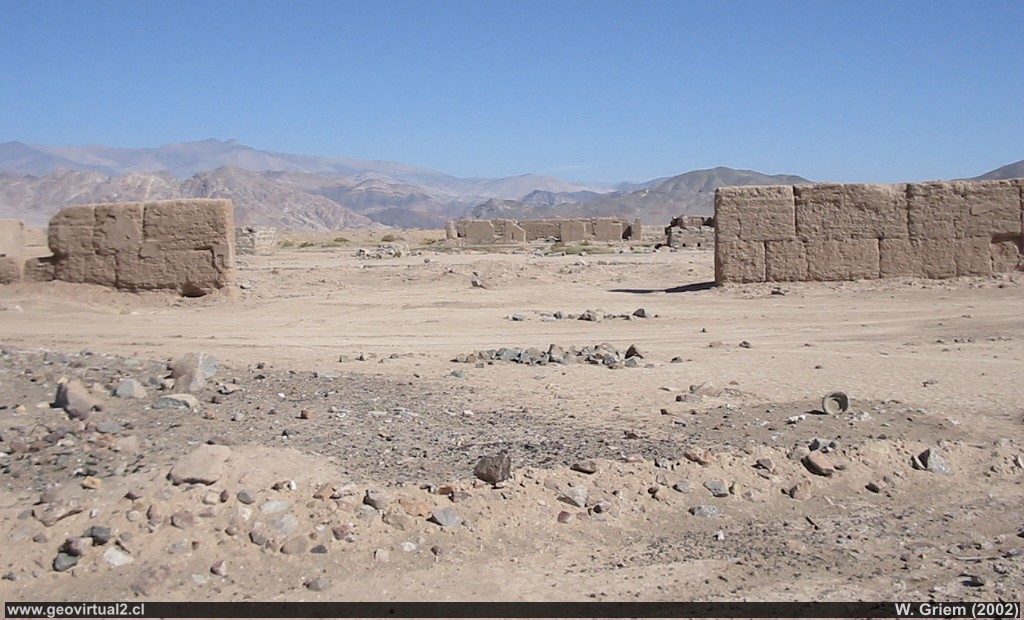
Photo: Remains of adobe walls from Carrera Pinto, Atacama Region - Chile. - Large Photo Grande (W. Griem 2002; CaPS318)
Information Photo:
Camera Canon Powershot-A100 (103-0318_IMG.JPG)
Longitud focal: 5,41mm (=44mm/35mm) | Tiempo: 1:1000
F: f/5.6 | Tamaño original: 1024 x 768 | Fecha: 2002/11/01/15:53 hrs.

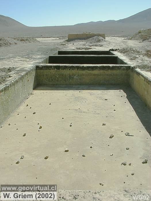
Photo: Remains of the plant in Carrera Pinto, Atacama Region; Photo W.Griem
(2011);
Ca50D4697 -
Large Photo
Large Photo Grande de 2002 - piscinas de la planta
Information Photo:
Camera Canon 50D (IMG_4697JPG)
Lente: 20mm +pol.| Longitud focal:
20mm (32,2/35mm) | Tiempo: 1:160 | ISO100
F: f/7.1 | Tamaño original: 4752 x 3168 | Fecha: 2011/01/09/14:11 hrs.
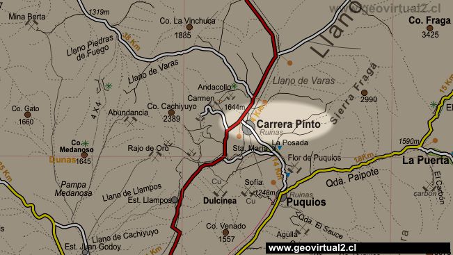
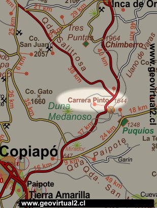
Carrera Pinto: p.1 │ p.2 │ Station │ Airfield
Carrera Pinto is located between
Copiapó and
Inca de Oro. The people have been abandoned in recent decades. Until
the 90s, one person and one kiosk remained.
Before Carrera Pinto was a very important mining village. Its location
between the early Puquios railway (see
here) and the
Tres Puntas mines ensured considerable passenger and metal traffic.
With the construction of the railroad
Chulo - Inca de Oro in 1908 (Yunge, 1910) Carrera Pinto was very
interesting for its nearby mines and some mineral concentration plants
were opened.
Located in the heart of the Varas plain and in the middle of several
important historical mining sectors (until the fifties) the ruins are
hidden in the infinite dimensions of the plain. But the whole railway
station, the plant, the village, an airstrip and on all sides pieces of
glass still show the importance of the sector some 70 years ago. Today
it's pure desert. Until the last place with people, Finca Santa Maria
was abandoned and it is almost time to remain in ruins forever.
*) En Yunge (1910) "Estadística Minera en Chile 1908 y 1909"
mention is made of the end of the construction of the route Chulo - Inca
de Oro in 1908..
Informative Chart
Place: Ruins of Carrera Pinto, Atacama Region
Location: UTM: E407.938 / N70.05.443 (Datum prov. SudAm. 1956)
Distance to Copiapó: 61,5 km
Height: 1640m
Atacama Region, Chile
Commune Copiapó, Province of Copiapó
Population: 0
Ruins of the village, Railway station, Mineral treatment plant, Finca
Santa María
Places of interest
Information about Atacama

Route Copiapó - Diego
Introducción
Copiapó (Km 0,0)
Chulo (Km 24,7)
Desert viewpoint (Km 34,9)
Ruins of Llampos
(km 50,0)
►Carrera
Pinto (km 61,5)
Carrera Pinto 1
Carrera Pinto 2
Estación FFCC Carrera Pinto
Aeródromo
Minas - distrito Carrera Pinto
Distrito Cachiyuyo de Llampos
Llano de Varas (km 70)
Chimberos (Km 84,6)
Inca de Oro (Km 101,7)
Llano San Pedro (km 115)
Diego de Almagro (Km 147,3)
Railroad history of Atacama
Estación FFCC Carrera Pinto
Minas del sector
Mining districts of Atacama
Minas de Carrera Pinto
Tres Puntas
Selected photos of the
desert
Virtual vantage point to the Desert
Related pages
Rutas de Atacama
Distancia entre ....
Mapas
Mining history of Atacama
Mining districts of Atacama
Tourist
information
Atacama
Travel instructions
Behavior in the desert
Specific terms
The Andes mountains
Atacama desert

