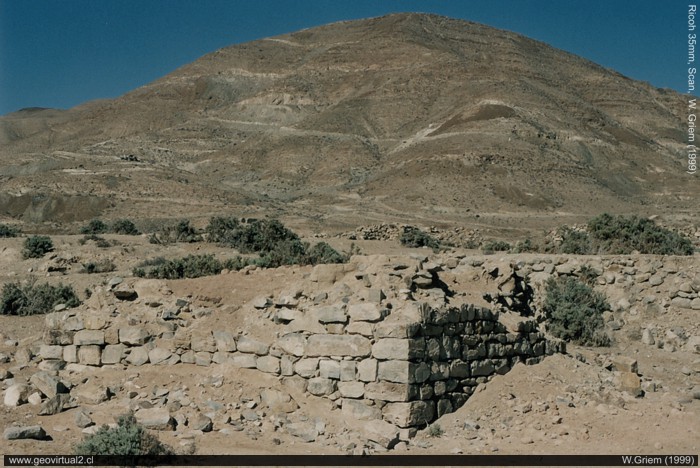
Photo: Ruins of the Juan Godoy
Village with Chañarcillo mines in the background, Atacama Region; Chile (W. Griem, 1999; Foto Ricoh)
Large Photo
Photo Information:
Camera Ricoh KR-10x | Focal Length: s/i | Time:
s/i
Original size: 35mm | Date: 1999
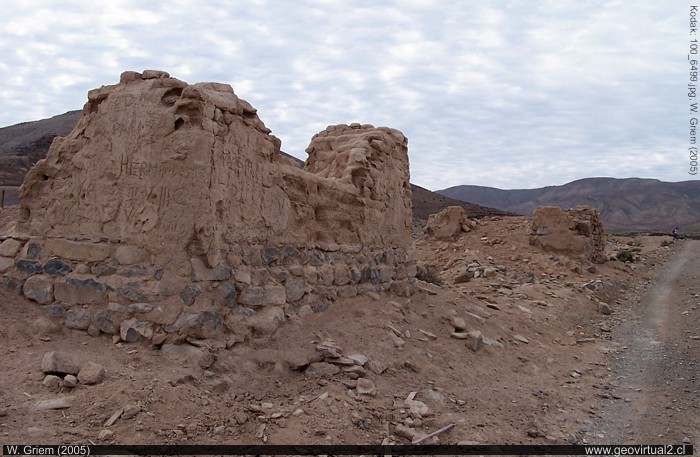
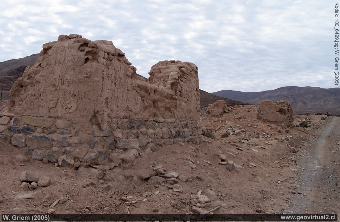
Photo: Ruins of Chañarcillo / Juan Godoy in the Atacama Region - Chile. (W. Griem, 2005; Kodak6499) - Large Photo
Photo Information: Camera Kodak DX6490
Focal Length: 6,3mm (=38/35mm)
| Time: 1:350
F: f/5.6 | Original size: 2304 x 1728 | Date:
2005/08/15/15:25 hrs.
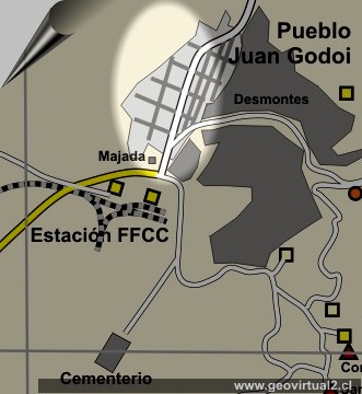
Informative Frame Juan Godoi /
Chañarcillo:
Atacama Statistics:
1952:3 inhabitants (source: XII. census)
1930:56 inhabitants (Mr, Cs) (source: X. census)
1920 205 inhabitants (source: Census 1920)
1895:954 inhabitants (1)
1885:1450 inhabitants (1)
1875:1963 inhabitants (1)
1853:6,277 inhabitants (1)
More statistics of the Atacama Region (here)
(1)= source: Visión Atacama, 1986
Chañarcillo: p.1 - p.2 - p. 3 - cemetery
Juan Godoy discovered the famous Chañarcillo silver
deposit in 1832. In the following years, a strong exploitation of the
rich veins began. Sometimes they found silver in its pure form or very
high grade veins (here).
Juan Godoy village was formed near the mine. In 1858 the railway line of
Caldera - Copiapó
-
Pabellón to Juan Godoy arrived.
(here)
Vetiform mineralization had extraordinarily high silver grades.
Chañarcillo was the third largest silver deposit worldwide. Names of
mines such as "Delirium" still show the spirit of the epoch. The riches
of the site supported the region in a considerable way in its
development. The gains allowed a large part of the country's external
debts to be repaid at this time.
(see pertenencias and
name of the mines)
But the rich areas were quickly exploited and production dropped
considerably. In addition, the mine was filled with groundwater because
of a blasting accident in 1888. At last all the mines were closed. In
1932, only one miner remained in this area. Chañarcillo's abandonment
between 1890 and 1905 has several reasons:
1. Depletion, deepening and technical problems in mines.
2. Extreme fall in the price of silver on the world market due to
changes in the monetary system.
3. New deposits - large and low-grade (= metal content) such as Elisa de
Bordos.
---
Atacama virtual
Mining Atacama
Intro Chañarcillo
►
Ruins Juan Godoy
Cemetery
Estación Ffcc Chañarcillo
Descubridora
Mina Dolores 1
Dolores 3
La Colorada
mas minas
Historia de Chañarcillo
Textos sobre Chañarcillo
Illustrationes of Chañarcillo
Descripción de las minas
Geología: Textos históricos
Tourist
information
Atacama
Travel instructions
Behavior in the desert
Specific terms
The Andes mountains
Atacama desert
Del sector
Carretera Panamericana
FFCC a Chañarcillo
FFCC longitudinal
Estación Castilla
Cerro Blanco
Pueblo Totoral
Related pages
Roads of Atacama
Distances between ....
Road
maps
Mining history of Atacama
Otros
Railroad history of Atacama
History
of Atacama
Mining history of Atacama
Flora Atacama
Fauna Atacama
Geología
Atacama
Clima Atacama
Atacama desert
Beaches and coast of Atacama
The Andes mountains
Rutas de Atacama
Carretera Panamericana
Aeródromos en Atacama
Moduls
Atacama black and white
Virtual viewpoint Atacama
Collection of Books

