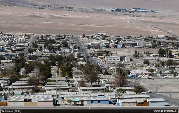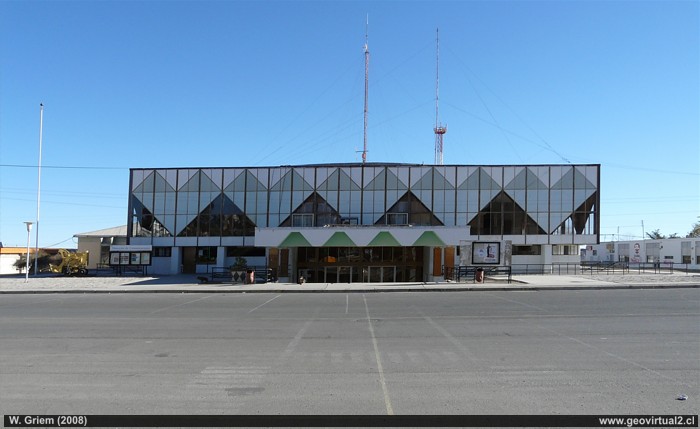
Photo: El Salvador 2008; Atacama Region - Chile. (W. Griem;
Panasonic2999) -
Large photo
Same photo of El Salvador en 1989
Photo Information: Camera Panasonic
DMC-FZ18 (P1020999.JPG)
Focal length: 18.8mm (114/35mm) | Time: 1:400 | ISO100
F: f/7.1 | Original size (px): 3264 x 2448 | Date: 2008/05/17/12:39hrs.

Photo: El Salvador, Atacama Region - Chile. W. Griem (2008; Panasonic2091) - Large Photo
Photo Information: Camera Panasonic
DMC-FZ18 (P1020091.JPG)
Focal length: 4.6mm (28/35mm) | Time: 1:200 | ISO100
F: f/7.1 | Original size (px): 3264 x 2448 | Date: 2008/05/01/17:09hrs.

El Salvador with its 11,000 inhabitants is located in
the Pre-Cordillera, 2300 m high. The city is heavily dependent on mining
in the same sector.
El Salvador is a fully planned city. It was built and inaugurated in
1959. There are several restaurants, hostels and fuel stations etc.. El
Salvador is an excellent base for excursions to the mountain range of
the
Pedernales,
La Ola and
Asientos
sector, since it is only a few kilometers away from those places.
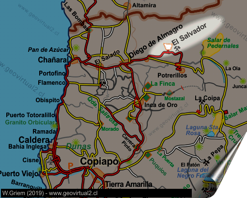
From Copiapó you can take the route to Caldera - Chañaral - Diego, or
the slightly shorter alternative of Copiapó - Inca de Oro - Diego de
Almagro. Both roads are paved and in good condition.
During a visit, you have to make a walking tour of the city. The
"modern" architecture of the 50s and 60s attracts attention.
Information
El Salvador:
• Population: 11,000 inhabitants (approx.)
• Height: 2240 m
• Distance to Santiago: 1007 km
• Distance to Copiapó: 203 km
• UTM: E437.450 / N70.96.860
• Restaurants, accommodation, shops, petrol, airport. LAN flights,
interprovincial buses.
Routes and nearby places:
Road to a Pedernales - Maricunga
Pedernales
Copiapó - Diego Route
Altamira Route
Places of interest
Information about Atacama

Towns and
villages of Atacama
Copiapó
Vallenar
●
El Salvador
Chañaral
Caldera
Diego de Almagro
Huasco
Freirina
Alto del Carmen
Tierra Amarilla
Nearby
Diego de Almagro
Pedernales
salt flat
Pan de Azucar
Chañaral
Mining area Inca
de Oro
Mining districts of Atacama
Inca de Oro
district
Tres Puntas
Railroad history of Atacama
Estación FFCC de Inca de Oro
Tourist
information
Atacama
Travel instructions
Behavior in the desert
Specific terms
The Andes mountains
Atacama desert

